WAWA WAWA - Earthquake Result Viewer
Earthquake location: Southern East Pacific Rise
Earthquake latitude/longitude: -55.8/-123.1
Earthquake time(UTC): 2015/12/24 (358) 19:44:03 GMT
Earthquake Depth: 12 km
Earthquake Magnitude: 6.2 MWW, 6.1 MWB, 6.2 MWC
Earthquake Catalog/Contributor: NEIC PDE/NEIC COMCAT
Network: YT POLENET
Station: WAWA WAWA
Lat/Lon: 81.58 S/28.42 W
Elevation: 1202 m
Distance: 36.0 deg
Az: 165.524 deg
Baz: 253.455 deg
Ray Param: 0.07691482
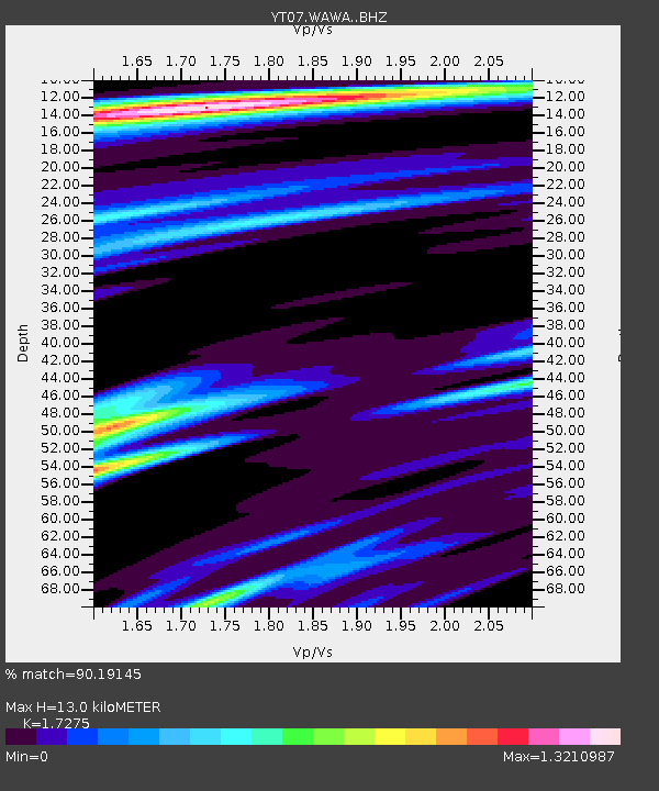
Estimated Moho Depth: 13.0 km
Estimated Crust Vp/Vs: 1.73
Assumed Crust Vp: 6.424 km/s
Estimated Crust Vs: 3.719 km/s
Estimated Crust Poisson's Ratio: 0.25
Radial Match: 90.19145 %
Radial Bump: 340
Transverse Match: 64.81921 %
Transverse Bump: 400
SOD ConfigId: 7422571
Insert Time: 2019-04-21 15:30:23.292 +0000
GWidth: 2.5
Max Bumps: 400
Tol: 0.001

Signal To Noise

ChannelStoNSTALTA
YT:WAWA: :BHZ:20151224T19:50:33.024989Z5.3499024.953531E-79.259106E-8
YT:WAWA: :BHN:20151224T19:50:33.024989Z1.1389358.299321E-87.286914E-8
YT:WAWA: :BHE:20151224T19:50:33.024989Z3.98272063.8694378E-79.715564E-8
Arrivals
Ps1.6 SECOND
PpPs5.1 SECOND
PsPs/PpSs6.7 SECOND