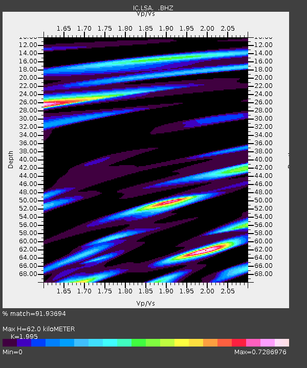
LSA Tibet, China - Earthquake Result Viewer
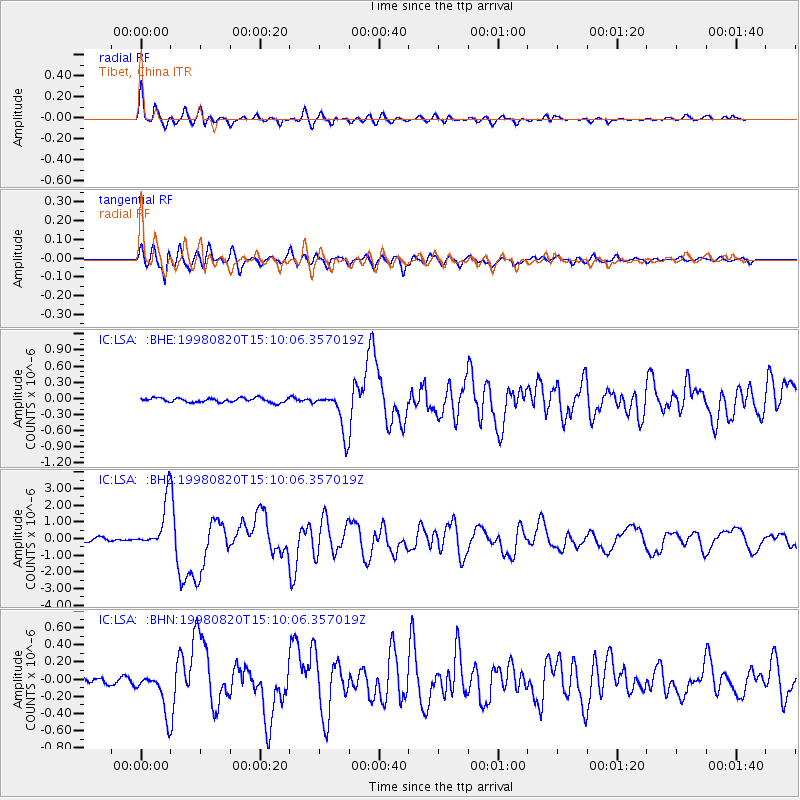
Earthquake location: Rat Islands, Aleutian Islands
Earthquake latitude/longitude: 51.6/175.2
Earthquake time(UTC): 1998/08/20 (232) 15:00:08 GMT
Earthquake Depth: 33 km
Earthquake Magnitude: 5.6 MB, 6.0 MS, 6.2 UNKNOWN, 6.2 MW
Earthquake Catalog/Contributor: WHDF/NEIC
Network: IC New China Digital Seismograph Network
Station: LSA Tibet, China
Lat/Lon: 29.70 N/91.15 E
Elevation: 3789 m
Distance: 63.8 deg
Az: 285.339 deg
Baz: 43.713 deg
Ray Param: 0.059273105
Estimated Moho Depth: 62.0 km
Estimated Crust Vp/Vs: 2.00
Assumed Crust Vp: 6.514 km/s
Estimated Crust Vs: 3.265 km/s
Estimated Crust Poisson's Ratio: 0.33
Radial Match: 91.93694 %
Radial Bump: 400
Transverse Match: 88.64808 %
Transverse Bump: 400
SOD ConfigId: 4480
Insert Time: 2010-03-04 22:52:32.884 +0000
GWidth: 2.5
Max Bumps: 400
Tol: 0.001

Signal To Noise

ChannelStoNSTALTA
IC:LSA: :BHZ:19980820T15:10:06.357019Z12.7667361.4776614E-61.1574309E-7
IC:LSA: :BHN:19980820T15:10:06.357019Z6.32612132.42569E-73.8344034E-8
IC:LSA: :BHE:19980820T15:10:06.357019Z9.4639213.7543438E-73.967007E-8
Arrivals
Ps9.8 SECOND
PpPs27 SECOND
PsPs/PpSs37 SECOND