
LSA Tibet, China - Earthquake Result Viewer
| ||||||||||||||||||
| ||||||||||||||||||
| ||||||||||||||||||
|
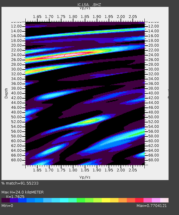
Signal To Noise
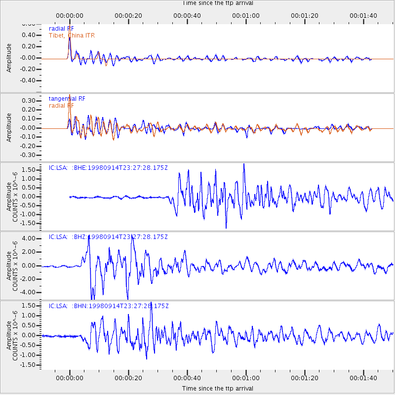
| Channel | StoN | STA | LTA |
| IC:LSA: :BHZ:19980914T23:27:28.175Z | 5.377195 | 4.5183702E-7 | 8.4028386E-8 |
| IC:LSA: :BHN:19980914T23:27:28.175Z | 2.3940098 | 6.5263905E-8 | 2.7261333E-8 |
| IC:LSA: :BHE:19980914T23:27:28.175Z | 2.9463634 | 1.0753923E-7 | 3.649897E-8 |
| Arrivals | |
| Ps | 2.9 SECOND |
| PpPs | 9.8 SECOND |
| PsPs/PpSs | 13 SECOND |

