LSA Tibet, China - Earthquake Result Viewer
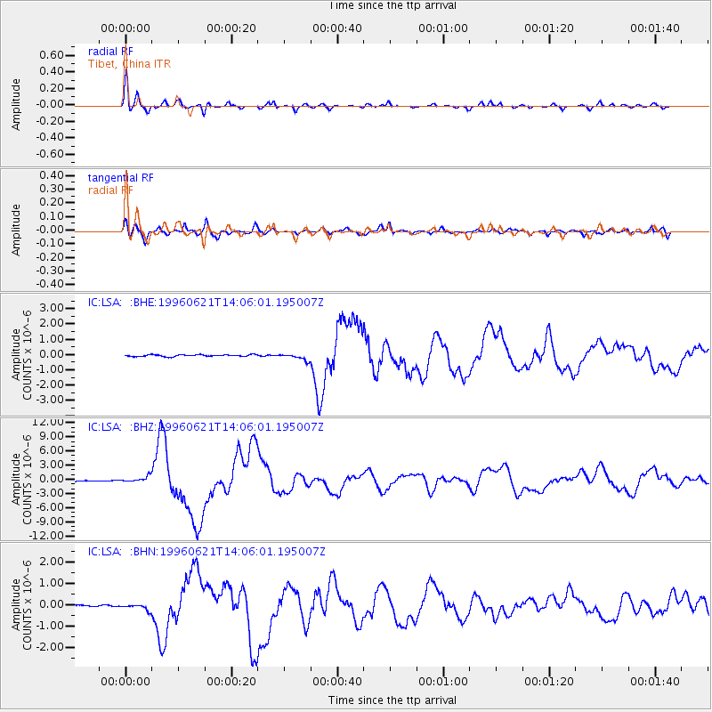
Earthquake location: Off East Coast Of Kamchatka
Earthquake latitude/longitude: 51.6/159.1
Earthquake time(UTC): 1996/06/21 (173) 13:57:10 GMT
Earthquake Depth: 20 km
Earthquake Magnitude: 6.0 MB, 6.6 MS, 7.0 UNKNOWN, 6.5 MS
Earthquake Catalog/Contributor: WHDF/NEIC
Network: IC New China Digital Seismograph Network
Station: LSA Tibet, China
Lat/Lon: 29.70 N/91.15 E
Elevation: 3789 m
Distance: 53.9 deg
Az: 273.737 deg
Baz: 45.712 deg
Ray Param: 0.065748535
Estimated Moho Depth: 17.0 km
Estimated Crust Vp/Vs: 1.71
Assumed Crust Vp: 6.514 km/s
Estimated Crust Vs: 3.81 km/s
Estimated Crust Poisson's Ratio: 0.24
Radial Match: 93.90939 %
Radial Bump: 346
Transverse Match: 90.137825 %
Transverse Bump: 400
SOD ConfigId: 4480
Insert Time: 2010-03-04 22:54:52.198 +0000
GWidth: 2.5
Max Bumps: 400
Tol: 0.001

Signal To Noise

ChannelStoNSTALTA
IC:LSA: :BHZ:19960621T14:06:01.195007Z7.33843476.6548E-79.0684196E-8
IC:LSA: :BHN:19960621T14:06:01.195007Z3.61515551.442532E-73.9902353E-8
IC:LSA: :BHE:19960621T14:06:01.195007Z3.94042852.2006087E-75.584694E-8
Arrivals
Ps2.0 SECOND
PpPs6.7 SECOND
PsPs/PpSs8.6 SECOND