
LSA Tibet, China - Earthquake Result Viewer
| ||||||||||||||||||
| ||||||||||||||||||
| ||||||||||||||||||
|
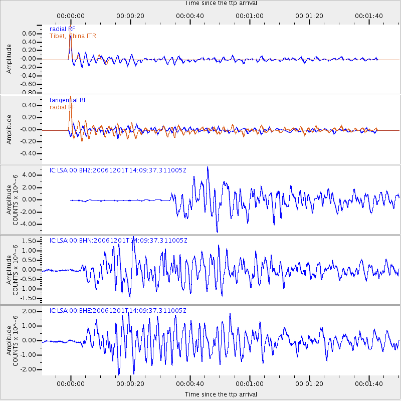
Signal To Noise
| Channel | StoN | STA | LTA |
| IC:LSA:00:BHN:20061201T14:09:37.311005Z | 3.5482705 | 9.3685145E-8 | 2.6403047E-8 |
| IC:LSA:00:BHE:20061201T14:09:37.311005Z | 2.1704795 | 1.1691367E-7 | 5.386536E-8 |
| IC:LSA:00:BHZ:20061201T14:09:37.311005Z | 5.594723 | 3.2309697E-7 | 5.7750302E-8 |
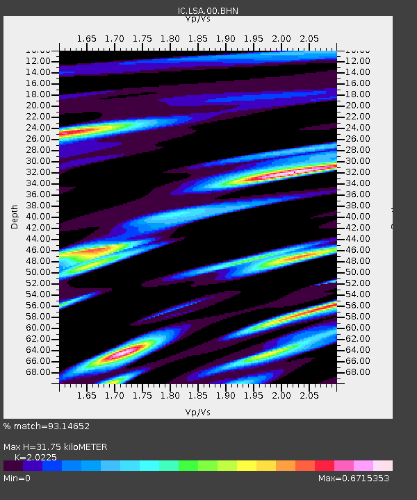
| Arrivals | |
| Ps | 5.3 SECOND |
| PpPs | 14 SECOND |
| PsPs/PpSs | 19 SECOND |

