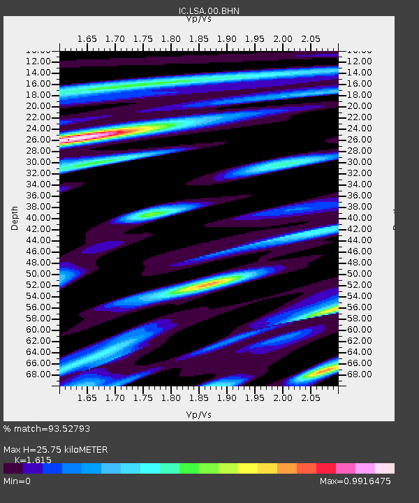
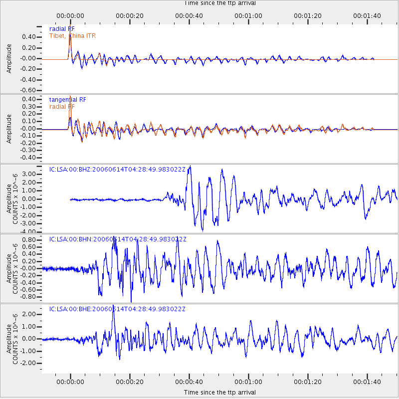
LSA Tibet, China - Earthquake Result Viewer

Earthquake location: Rat Islands, Aleutian Islands
Earthquake latitude/longitude: 51.8/177.1
Earthquake time(UTC): 2006/06/14 (165) 04:18:42 GMT
Earthquake Depth: 14 km
Earthquake Magnitude: 5.9 MB, 6.4 MS, 6.4 MW, 6.4 MW
Earthquake Catalog/Contributor: WHDF/NEIC
Network: IC New China Digital Seismograph Network
Station: LSA Tibet, China
Lat/Lon: 29.70 N/91.15 E
Elevation: 3789 m
Distance: 64.9 deg
Az: 286.561 deg
Baz: 43.222 deg
Ray Param: 0.058629192
Estimated Moho Depth: 25.75 km
Estimated Crust Vp/Vs: 1.62
Assumed Crust Vp: 6.514 km/s
Estimated Crust Vs: 4.034 km/s
Estimated Crust Poisson's Ratio: 0.19
Radial Match: 93.52793 %
Radial Bump: 400
Transverse Match: 89.57961 %
Transverse Bump: 400
SOD ConfigId: 5745
Insert Time: 2010-03-04 22:55:53.766 +0000
GWidth: 2.5
Max Bumps: 400
Tol: 0.001

Signal To Noise

ChannelStoNSTALTA
IC:LSA:00:BHN:20060614T04:28:49.983022Z1.36524124.4689127E-83.2733507E-8
IC:LSA:00:BHE:20060614T04:28:49.983022Z2.89509151.3680327E-74.7253522E-8
IC:LSA:00:BHZ:20060614T04:28:49.983022Z5.8995973.4024205E-75.7672082E-8
Arrivals
Ps2.5 SECOND
PpPs9.9 SECOND
PsPs/PpSs12 SECOND