You are here: Home > Network List > CI - Caltech Regional Seismic Network Stations List
> Station SWS Sam W. Stewart, Westmorland, CA, USA > Earthquake Result Viewer
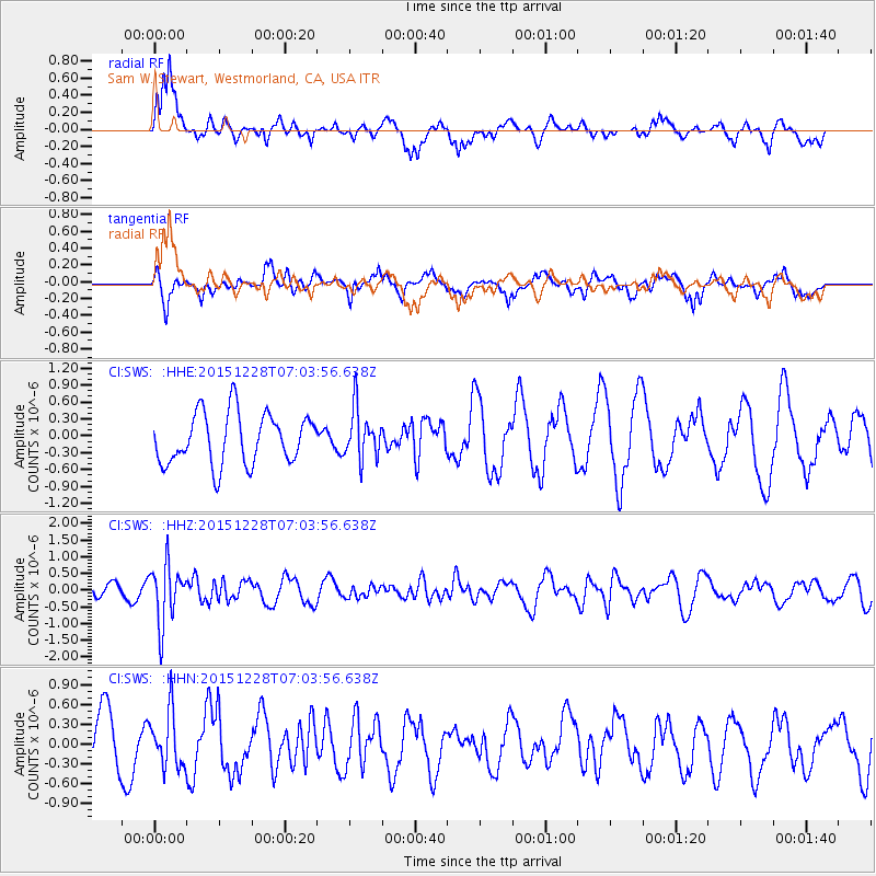
SWS Sam W. Stewart, Westmorland, CA, USA - Earthquake Result Viewer
*The percent match for this event was below the threshold and hence no stack was calculated.
| Earthquake location: |
Windward Islands |
| Earthquake latitude/longitude: |
14.6/-61.4 |
| Earthquake time(UTC): |
2015/12/28 (362) 06:55:30 GMT |
| Earthquake Depth: |
153 km |
| Earthquake Magnitude: |
5.6 MWP |
| Earthquake Catalog/Contributor: |
NEIC PDE/NEIC COMCAT |
|
| Network: |
CI Caltech Regional Seismic Network |
| Station: |
SWS Sam W. Stewart, Westmorland, CA, USA |
| Lat/Lon: |
32.94 N/115.80 W |
| Elevation: |
140 m |
|
| Distance: |
52.5 deg |
| Az: |
300.413 deg |
| Baz: |
96.828 deg |
| Ray Param: |
$rayparam |
*The percent match for this event was below the threshold and hence was not used in the summary stack. |
|
| Radial Match: |
58.531853 % |
| Radial Bump: |
400 |
| Transverse Match: |
55.011753 % |
| Transverse Bump: |
396 |
| SOD ConfigId: |
7422571 |
| Insert Time: |
2019-04-21 15:55:15.496 +0000 |
| GWidth: |
2.5 |
| Max Bumps: |
400 |
| Tol: |
0.001 |
|
Signal To Noise
| Channel | StoN | STA | LTA |
| CI:SWS: :HHZ:20151228T07:03:56.638Z | 5.777931 | 8.7104064E-7 | 1.5075302E-7 |
| CI:SWS: :HHN:20151228T07:03:56.638Z | 0.7308581 | 4.1348542E-7 | 5.657534E-7 |
| CI:SWS: :HHE:20151228T07:03:56.638Z | 0.9819569 | 4.4305074E-7 | 4.5119162E-7 |
| Arrivals |
| Ps | |
| PpPs | |
| PsPs/PpSs | |


