You are here: Home > Network List > CN - Canadian National Seismograph Network Stations List
> Station INK INUVIK, NT > Earthquake Result Viewer
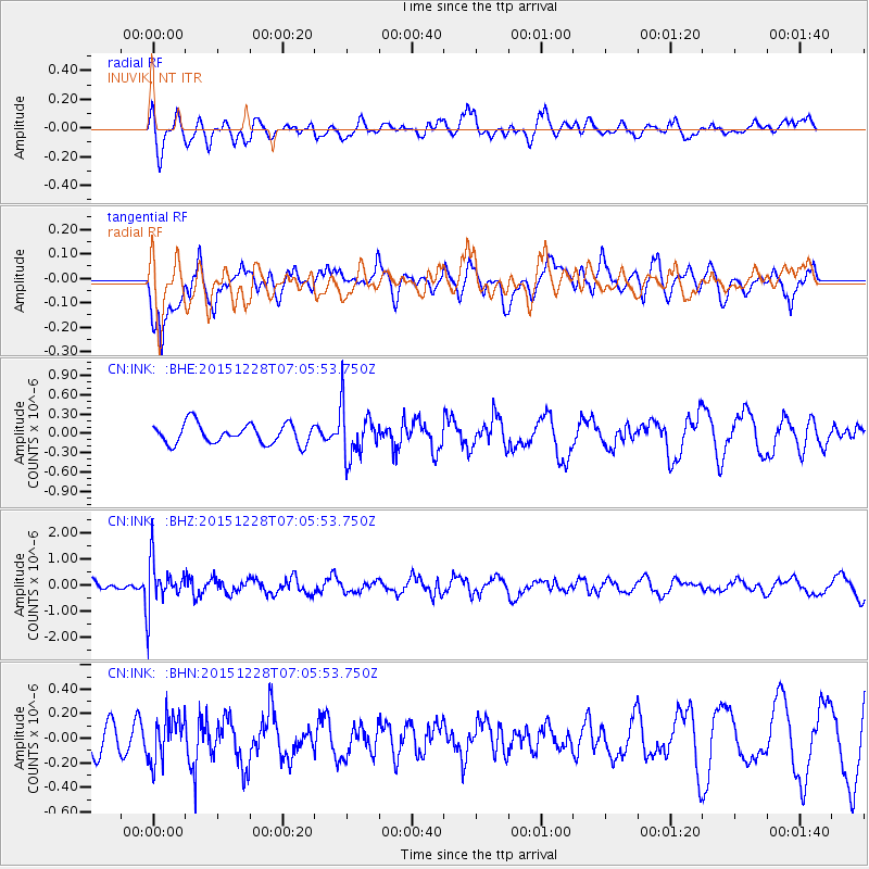
INK INUVIK, NT - Earthquake Result Viewer
*The percent match for this event was below the threshold and hence no stack was calculated.
| Earthquake location: |
Windward Islands |
| Earthquake latitude/longitude: |
14.6/-61.4 |
| Earthquake time(UTC): |
2015/12/28 (362) 06:55:30 GMT |
| Earthquake Depth: |
153 km |
| Earthquake Magnitude: |
5.6 MWP |
| Earthquake Catalog/Contributor: |
NEIC PDE/NEIC COMCAT |
|
| Network: |
CN Canadian National Seismograph Network |
| Station: |
INK INUVIK, NT |
| Lat/Lon: |
68.31 N/133.53 W |
| Elevation: |
44 m |
|
| Distance: |
70.0 deg |
| Az: |
337.869 deg |
| Baz: |
101.192 deg |
| Ray Param: |
$rayparam |
*The percent match for this event was below the threshold and hence was not used in the summary stack. |
|
| Radial Match: |
45.93607 % |
| Radial Bump: |
379 |
| Transverse Match: |
64.48259 % |
| Transverse Bump: |
400 |
| SOD ConfigId: |
7422571 |
| Insert Time: |
2019-04-21 15:55:36.166 +0000 |
| GWidth: |
2.5 |
| Max Bumps: |
400 |
| Tol: |
0.001 |
|
Signal To Noise
| Channel | StoN | STA | LTA |
| CN:INK: :BHZ:20151228T07:05:53.750Z | 4.800395 | 9.256124E-7 | 1.9282005E-7 |
| CN:INK: :BHN:20151228T07:05:53.750Z | 0.83297634 | 1.853916E-7 | 2.2256526E-7 |
| CN:INK: :BHE:20151228T07:05:53.750Z | 2.5184379 | 3.8832772E-7 | 1.5419388E-7 |
| Arrivals |
| Ps | |
| PpPs | |
| PsPs/PpSs | |


