
LSA Tibet, China - Earthquake Result Viewer
| ||||||||||||||||||
| ||||||||||||||||||
| ||||||||||||||||||
|
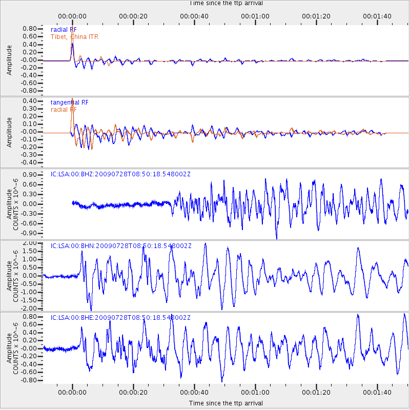
Signal To Noise
| Channel | StoN | STA | LTA |
| IC:LSA:00:BHN:20090728T08:50:18.548002Z | 11.275723 | 5.66873E-7 | 5.027376E-8 |
| IC:LSA:00:BHE:20090728T08:50:18.548002Z | 5.9707384 | 1.9145072E-7 | 3.2064833E-8 |
| IC:LSA:00:BHZ:20090728T08:50:18.548002Z | 2.5882123 | 1.19047975E-7 | 4.599622E-8 |
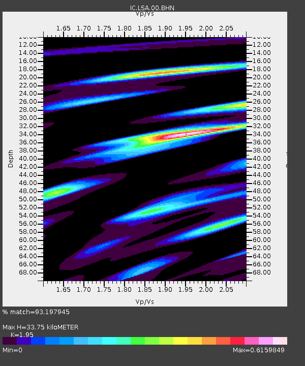
| Arrivals | |
| Ps | 5.3 SECOND |
| PpPs | 14 SECOND |
| PsPs/PpSs | 20 SECOND |

