You are here: Home > Network List > US - United States National Seismic Network Stations List
> Station HAWA Hanford, Washington, USA > Earthquake Result Viewer
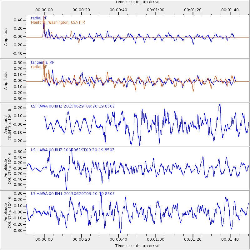
HAWA Hanford, Washington, USA - Earthquake Result Viewer
*The percent match for this event was below the threshold and hence no stack was calculated.
| Earthquake location: |
Near Coast Of Peru |
| Earthquake latitude/longitude: |
-16.0/-74.2 |
| Earthquake time(UTC): |
2015/06/29 (180) 09:09:15 GMT |
| Earthquake Depth: |
24 km |
| Earthquake Magnitude: |
5.5 MB |
| Earthquake Catalog/Contributor: |
NEIC PDE/NEIC ALERT |
|
| Network: |
US United States National Seismic Network |
| Station: |
HAWA Hanford, Washington, USA |
| Lat/Lon: |
46.39 N/119.53 W |
| Elevation: |
364 m |
|
| Distance: |
74.3 deg |
| Az: |
329.259 deg |
| Baz: |
134.747 deg |
| Ray Param: |
$rayparam |
*The percent match for this event was below the threshold and hence was not used in the summary stack. |
|
| Radial Match: |
62.38458 % |
| Radial Bump: |
400 |
| Transverse Match: |
55.12518 % |
| Transverse Bump: |
400 |
| SOD ConfigId: |
976571 |
| Insert Time: |
2015-07-13 09:21:35.182 +0000 |
| GWidth: |
2.5 |
| Max Bumps: |
400 |
| Tol: |
0.001 |
|
Signal To Noise
| Channel | StoN | STA | LTA |
| US:HAWA:00:BHZ:20150629T09:20:19.850Z | 2.5275288 | 2.2793236E-7 | 9.017993E-8 |
| US:HAWA:00:BH1:20150629T09:20:19.850Z | 0.5836385 | 4.5245674E-8 | 7.752346E-8 |
| US:HAWA:00:BH2:20150629T09:20:19.850Z | 1.3396056 | 8.120323E-8 | 6.0617275E-8 |
| Arrivals |
| Ps | |
| PpPs | |
| PsPs/PpSs | |


