You are here: Home > Network List > IC - New China Digital Seismograph Network Stations List
> Station LSA Tibet, China > Earthquake Result Viewer
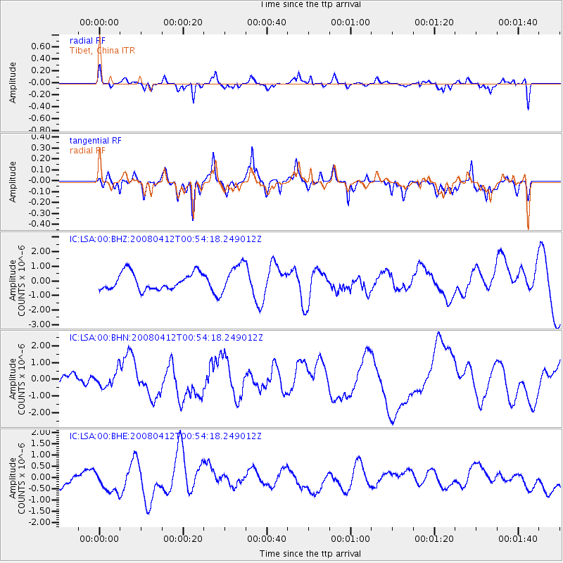
LSA Tibet, China - Earthquake Result Viewer
*The percent match for this event was below the threshold and hence no stack was calculated.
| Earthquake location: |
Kuril Islands |
| Earthquake latitude/longitude: |
43.9/147.5 |
| Earthquake time(UTC): |
2008/04/12 (103) 00:46:28 GMT |
| Earthquake Depth: |
64 km |
| Earthquake Magnitude: |
5.7 MB |
| Earthquake Catalog/Contributor: |
WHDF/NEIC |
|
| Network: |
IC New China Digital Seismograph Network |
| Station: |
LSA Tibet, China |
| Lat/Lon: |
29.70 N/91.15 E |
| Elevation: |
3789 m |
|
| Distance: |
46.4 deg |
| Az: |
271.856 deg |
| Baz: |
56.17 deg |
| Ray Param: |
$rayparam |
*The percent match for this event was below the threshold and hence was not used in the summary stack. |
|
| Radial Match: |
57.5771 % |
| Radial Bump: |
348 |
| Transverse Match: |
55.74046 % |
| Transverse Bump: |
400 |
| SOD ConfigId: |
2504 |
| Insert Time: |
2010-03-04 22:56:55.069 +0000 |
| GWidth: |
2.5 |
| Max Bumps: |
400 |
| Tol: |
0.001 |
|
Signal To Noise
| Channel | StoN | STA | LTA |
| IC:LSA:00:BHN:20080412T00:54:18.249012Z | 0.49447176 | 5.051562E-7 | 1.0216078E-6 |
| IC:LSA:00:BHE:20080412T00:54:18.249012Z | 1.0483482 | 5.02007E-7 | 4.788552E-7 |
| IC:LSA:00:BHZ:20080412T00:54:18.249012Z | 1.7320856 | 9.899259E-7 | 5.715225E-7 |
| Arrivals |
| Ps | |
| PpPs | |
| PsPs/PpSs | |


