You are here: Home > Network List > TA - USArray Transportable Network (new EarthScope stations) Stations List
> Station BGNE Belgrade, NE, USA > Earthquake Result Viewer
BGNE Belgrade, NE, USA - Earthquake Result Viewer
*The percent match for this event was below the threshold and hence no stack was calculated.
| Earthquake location: |
Windward Islands |
| Earthquake latitude/longitude: |
14.6/-61.4 |
| Earthquake time(UTC): |
2015/12/28 (362) 06:55:30 GMT |
| Earthquake Depth: |
153 km |
| Earthquake Magnitude: |
5.6 MWP |
| Earthquake Catalog/Contributor: |
NEIC PDE/NEIC COMCAT |
|
| Network: |
TA USArray Transportable Network (new EarthScope stations) |
| Station: |
BGNE Belgrade, NE, USA |
| Lat/Lon: |
41.41 N/98.15 W |
| Elevation: |
573 m |
|
| Distance: |
41.6 deg |
| Az: |
317.243 deg |
| Baz: |
119.099 deg |
| Ray Param: |
$rayparam |
*The percent match for this event was below the threshold and hence was not used in the summary stack. |
|
| Radial Match: |
73.77192 % |
| Radial Bump: |
303 |
| Transverse Match: |
56.3435 % |
| Transverse Bump: |
400 |
| SOD ConfigId: |
7422571 |
| Insert Time: |
2019-04-21 16:00:41.166 +0000 |
| GWidth: |
2.5 |
| Max Bumps: |
400 |
| Tol: |
0.001 |
|
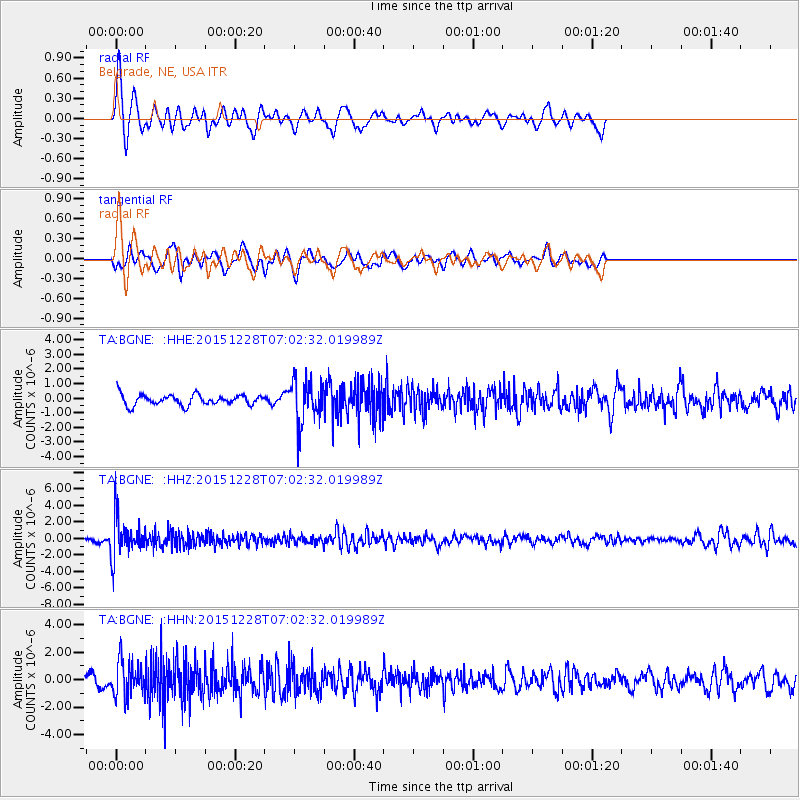
Signal To Noise
| Channel | StoN | STA | LTA |
| TA:BGNE: :HHZ:20151228T07:02:32.019989Z | 9.310651 | 2.3439616E-6 | 2.5175058E-7 |
| TA:BGNE: :HHN:20151228T07:02:32.019989Z | 3.1417334 | 1.3089197E-6 | 4.166234E-7 |
| TA:BGNE: :HHE:20151228T07:02:32.019989Z | 4.155279 | 1.5045563E-6 | 3.6208309E-7 |
| Arrivals |
| Ps | |
| PpPs | |
| PsPs/PpSs | |


