You are here: Home > Network List > TA - USArray Transportable Network (new EarthScope stations) Stations List
> Station O03E Paynes Creek, CA, USA > Earthquake Result Viewer
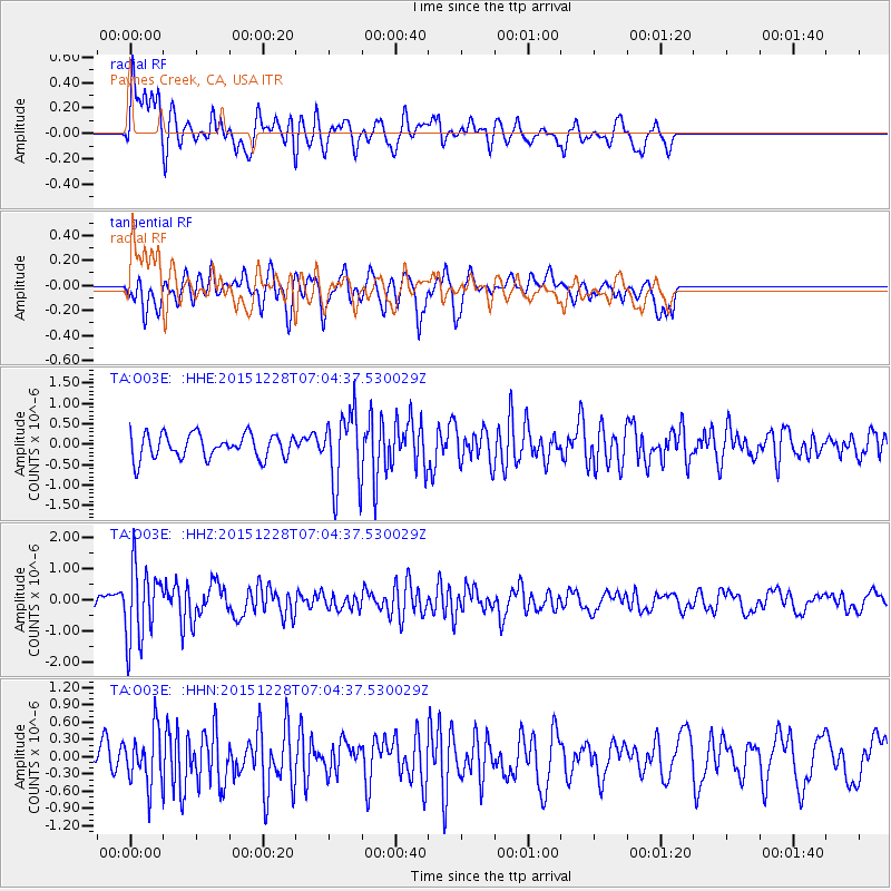
O03E Paynes Creek, CA, USA - Earthquake Result Viewer
*The percent match for this event was below the threshold and hence no stack was calculated.
| Earthquake location: |
Windward Islands |
| Earthquake latitude/longitude: |
14.6/-61.4 |
| Earthquake time(UTC): |
2015/12/28 (362) 06:55:30 GMT |
| Earthquake Depth: |
153 km |
| Earthquake Magnitude: |
5.6 MWP |
| Earthquake Catalog/Contributor: |
NEIC PDE/NEIC COMCAT |
|
| Network: |
TA USArray Transportable Network (new EarthScope stations) |
| Station: |
O03E Paynes Creek, CA, USA |
| Lat/Lon: |
40.29 N/121.80 W |
| Elevation: |
967 m |
|
| Distance: |
58.2 deg |
| Az: |
308.5 deg |
| Baz: |
97.861 deg |
| Ray Param: |
$rayparam |
*The percent match for this event was below the threshold and hence was not used in the summary stack. |
|
| Radial Match: |
65.29101 % |
| Radial Bump: |
400 |
| Transverse Match: |
65.8242 % |
| Transverse Bump: |
400 |
| SOD ConfigId: |
7422571 |
| Insert Time: |
2019-04-21 16:01:10.333 +0000 |
| GWidth: |
2.5 |
| Max Bumps: |
400 |
| Tol: |
0.001 |
|
Signal To Noise
| Channel | StoN | STA | LTA |
| TA:O03E: :HHZ:20151228T07:04:37.530029Z | 5.6268725 | 1.1660051E-6 | 2.0722081E-7 |
| TA:O03E: :HHN:20151228T07:04:37.530029Z | 1.7096281 | 4.6874558E-7 | 2.7417985E-7 |
| TA:O03E: :HHE:20151228T07:04:37.530029Z | 2.9918668 | 8.8476656E-7 | 2.957239E-7 |
| Arrivals |
| Ps | |
| PpPs | |
| PsPs/PpSs | |


