You are here: Home > Network List > TA - USArray Transportable Network (new EarthScope stations) Stations List
> Station T25A Trinidad, CO, USA > Earthquake Result Viewer
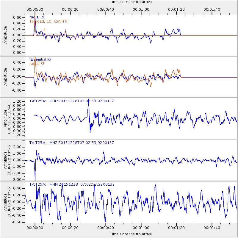
T25A Trinidad, CO, USA - Earthquake Result Viewer
*The percent match for this event was below the threshold and hence no stack was calculated.
| Earthquake location: |
Windward Islands |
| Earthquake latitude/longitude: |
14.6/-61.4 |
| Earthquake time(UTC): |
2015/12/28 (362) 06:55:30 GMT |
| Earthquake Depth: |
153 km |
| Earthquake Magnitude: |
5.6 MWP |
| Earthquake Catalog/Contributor: |
NEIC PDE/NEIC COMCAT |
|
| Network: |
TA USArray Transportable Network (new EarthScope stations) |
| Station: |
T25A Trinidad, CO, USA |
| Lat/Lon: |
37.14 N/104.41 W |
| Elevation: |
2017 m |
|
| Distance: |
44.3 deg |
| Az: |
308.625 deg |
| Baz: |
108.829 deg |
| Ray Param: |
$rayparam |
*The percent match for this event was below the threshold and hence was not used in the summary stack. |
|
| Radial Match: |
57.209717 % |
| Radial Bump: |
400 |
| Transverse Match: |
52.377457 % |
| Transverse Bump: |
360 |
| SOD ConfigId: |
7422571 |
| Insert Time: |
2019-04-21 16:01:18.951 +0000 |
| GWidth: |
2.5 |
| Max Bumps: |
400 |
| Tol: |
0.001 |
|
Signal To Noise
| Channel | StoN | STA | LTA |
| TA:T25A: :HHZ:20151228T07:02:53.920013Z | 7.098042 | 8.4884715E-7 | 1.1958892E-7 |
| TA:T25A: :HHN:20151228T07:02:53.920013Z | 1.0749332 | 2.6343005E-7 | 2.4506645E-7 |
| TA:T25A: :HHE:20151228T07:02:53.920013Z | 3.2131965 | 5.232729E-7 | 1.628512E-7 |
| Arrivals |
| Ps | |
| PpPs | |
| PsPs/PpSs | |


