You are here: Home > Network List > TA - USArray Transportable Network (new EarthScope stations) Stations List
> Station W41B Gary Mavity, Velonia, AR, USA > Earthquake Result Viewer
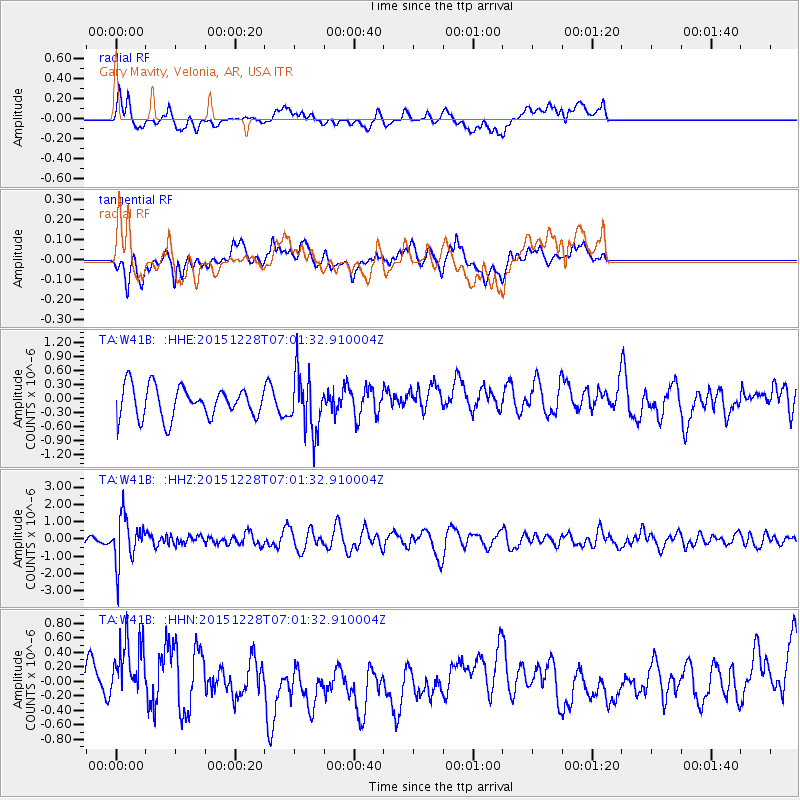
W41B Gary Mavity, Velonia, AR, USA - Earthquake Result Viewer
*The percent match for this event was below the threshold and hence no stack was calculated.
| Earthquake location: |
Windward Islands |
| Earthquake latitude/longitude: |
14.6/-61.4 |
| Earthquake time(UTC): |
2015/12/28 (362) 06:55:30 GMT |
| Earthquake Depth: |
153 km |
| Earthquake Magnitude: |
5.6 MWP |
| Earthquake Catalog/Contributor: |
NEIC PDE/NEIC COMCAT |
|
| Network: |
TA USArray Transportable Network (new EarthScope stations) |
| Station: |
W41B Gary Mavity, Velonia, AR, USA |
| Lat/Lon: |
35.17 N/92.25 W |
| Elevation: |
95 m |
|
| Distance: |
34.5 deg |
| Az: |
312.046 deg |
| Baz: |
118.646 deg |
| Ray Param: |
$rayparam |
*The percent match for this event was below the threshold and hence was not used in the summary stack. |
|
| Radial Match: |
47.882797 % |
| Radial Bump: |
400 |
| Transverse Match: |
36.51394 % |
| Transverse Bump: |
400 |
| SOD ConfigId: |
7422571 |
| Insert Time: |
2019-04-21 16:01:23.897 +0000 |
| GWidth: |
2.5 |
| Max Bumps: |
400 |
| Tol: |
0.001 |
|
Signal To Noise
| Channel | StoN | STA | LTA |
| TA:W41B: :HHZ:20151228T07:01:32.910004Z | 4.8120627 | 1.3494143E-6 | 2.8042328E-7 |
| TA:W41B: :HHN:20151228T07:01:32.910004Z | 1.1835461 | 3.7930502E-7 | 3.2048183E-7 |
| TA:W41B: :HHE:20151228T07:01:32.910004Z | 1.8131241 | 6.0925703E-7 | 3.3602612E-7 |
| Arrivals |
| Ps | |
| PpPs | |
| PsPs/PpSs | |


