You are here: Home > Network List > IC - New China Digital Seismograph Network Stations List
> Station LSA Tibet, China > Earthquake Result Viewer
LSA Tibet, China - Earthquake Result Viewer
*The percent match for this event was below the threshold and hence no stack was calculated.
| Earthquake location: |
Southeast Of Loyalty Islands |
| Earthquake latitude/longitude: |
-21.7/170.5 |
| Earthquake time(UTC): |
2008/09/12 (256) 16:44:30 GMT |
| Earthquake Depth: |
116 km |
| Earthquake Magnitude: |
5.8 MW, 5.4 MB, 5.8 MW |
| Earthquake Catalog/Contributor: |
WHDF/NEIC |
|
| Network: |
IC New China Digital Seismograph Network |
| Station: |
LSA Tibet, China |
| Lat/Lon: |
29.70 N/91.15 E |
| Elevation: |
3789 m |
|
| Distance: |
91.8 deg |
| Az: |
301.196 deg |
| Baz: |
113.875 deg |
| Ray Param: |
$rayparam |
*The percent match for this event was below the threshold and hence was not used in the summary stack. |
|
| Radial Match: |
59.978157 % |
| Radial Bump: |
400 |
| Transverse Match: |
56.664185 % |
| Transverse Bump: |
400 |
| SOD ConfigId: |
2560 |
| Insert Time: |
2010-03-04 22:57:20.120 +0000 |
| GWidth: |
2.5 |
| Max Bumps: |
400 |
| Tol: |
0.001 |
|
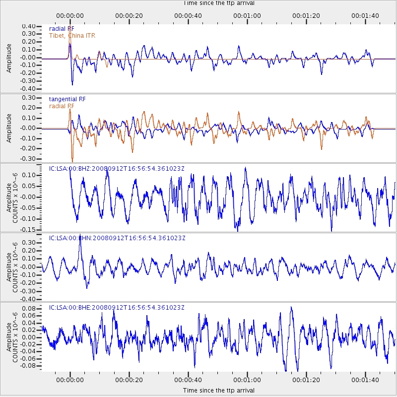
Signal To Noise
| Channel | StoN | STA | LTA |
| IC:LSA:00:BHN:20080912T16:56:54.361023Z | 2.0579498 | 1.3189994E-7 | 6.409288E-8 |
| IC:LSA:00:BHE:20080912T16:56:54.361023Z | 0.5969722 | 1.7259246E-8 | 2.8911305E-8 |
| IC:LSA:00:BHZ:20080912T16:56:54.361023Z | 0.9560099 | 5.436226E-8 | 5.6863698E-8 |
| Arrivals |
| Ps | |
| PpPs | |
| PsPs/PpSs | |


