You are here: Home > Network List > IC - New China Digital Seismograph Network Stations List
> Station LSA Tibet, China > Earthquake Result Viewer
LSA Tibet, China - Earthquake Result Viewer
*The percent match for this event was below the threshold and hence no stack was calculated.
| Earthquake location: |
Komandorskiye Ostrova Region |
| Earthquake latitude/longitude: |
56.3/164.1 |
| Earthquake time(UTC): |
2008/09/12 (256) 23:07:50 GMT |
| Earthquake Depth: |
9.3 km |
| Earthquake Magnitude: |
5.5 MB, 5.7 MS, 5.9 MW, 5.9 MW |
| Earthquake Catalog/Contributor: |
WHDF/NEIC |
|
| Network: |
IC New China Digital Seismograph Network |
| Station: |
LSA Tibet, China |
| Lat/Lon: |
29.70 N/91.15 E |
| Elevation: |
3789 m |
|
| Distance: |
56.5 deg |
| Az: |
274.317 deg |
| Baz: |
39.699 deg |
| Ray Param: |
$rayparam |
*The percent match for this event was below the threshold and hence was not used in the summary stack. |
|
| Radial Match: |
77.66701 % |
| Radial Bump: |
400 |
| Transverse Match: |
60.26953 % |
| Transverse Bump: |
400 |
| SOD ConfigId: |
2560 |
| Insert Time: |
2010-03-04 22:57:21.292 +0000 |
| GWidth: |
2.5 |
| Max Bumps: |
400 |
| Tol: |
0.001 |
|
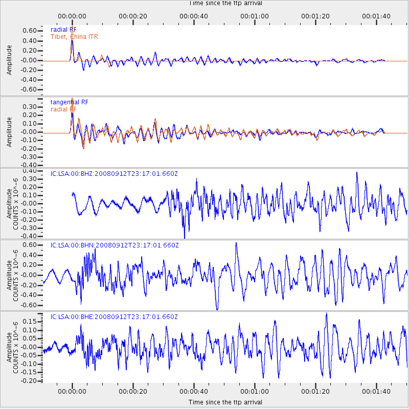
Signal To Noise
| Channel | StoN | STA | LTA |
| IC:LSA:00:BHN:20080912T23:17:01.660Z | 3.351354 | 2.1379832E-7 | 6.379461E-8 |
| IC:LSA:00:BHE:20080912T23:17:01.660Z | 1.716233 | 5.5523248E-8 | 3.235181E-8 |
| IC:LSA:00:BHZ:20080912T23:17:01.660Z | 1.3704649 | 8.782747E-8 | 6.40859E-8 |
| Arrivals |
| Ps | |
| PpPs | |
| PsPs/PpSs | |


