You are here: Home > Network List > IC - New China Digital Seismograph Network Stations List
> Station LSA Tibet, China > Earthquake Result Viewer
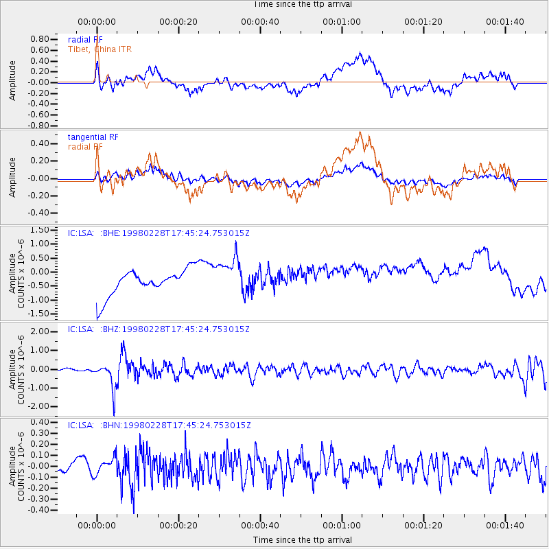
LSA Tibet, China - Earthquake Result Viewer
*The percent match for this event was below the threshold and hence no stack was calculated.
| Earthquake location: |
Southeast Of Honshu, Japan |
| Earthquake latitude/longitude: |
33.5/138.1 |
| Earthquake time(UTC): |
1998/02/28 (059) 17:38:48 GMT |
| Earthquake Depth: |
291 km |
| Earthquake Magnitude: |
5.7 UNKNOWN, 5.3 MB, 5.7 MW |
| Earthquake Catalog/Contributor: |
WHDF/NEIC |
|
| Network: |
IC New China Digital Seismograph Network |
| Station: |
LSA Tibet, China |
| Lat/Lon: |
29.70 N/91.15 E |
| Elevation: |
3789 m |
|
| Distance: |
39.9 deg |
| Az: |
277.729 deg |
| Baz: |
72.197 deg |
| Ray Param: |
$rayparam |
*The percent match for this event was below the threshold and hence was not used in the summary stack. |
|
| Radial Match: |
32.839176 % |
| Radial Bump: |
400 |
| Transverse Match: |
36.523922 % |
| Transverse Bump: |
400 |
| SOD ConfigId: |
4480 |
| Insert Time: |
2010-03-04 22:57:25.628 +0000 |
| GWidth: |
2.5 |
| Max Bumps: |
400 |
| Tol: |
0.001 |
|
Signal To Noise
| Channel | StoN | STA | LTA |
| IC:LSA: :BHZ:19980228T17:45:24.753015Z | 8.477842 | 7.1012204E-7 | 8.376211E-8 |
| IC:LSA: :BHN:19980228T17:45:24.753015Z | 2.0820131 | 7.691892E-8 | 3.6944495E-8 |
| IC:LSA: :BHE:19980228T17:45:24.753015Z | 1.4763491 | 6.8971815E-7 | 4.6717824E-7 |
| Arrivals |
| Ps | |
| PpPs | |
| PsPs/PpSs | |


