You are here: Home > Network List > AZ - ANZA Regional Network Stations List
> Station SMER AZ.SMER > Earthquake Result Viewer
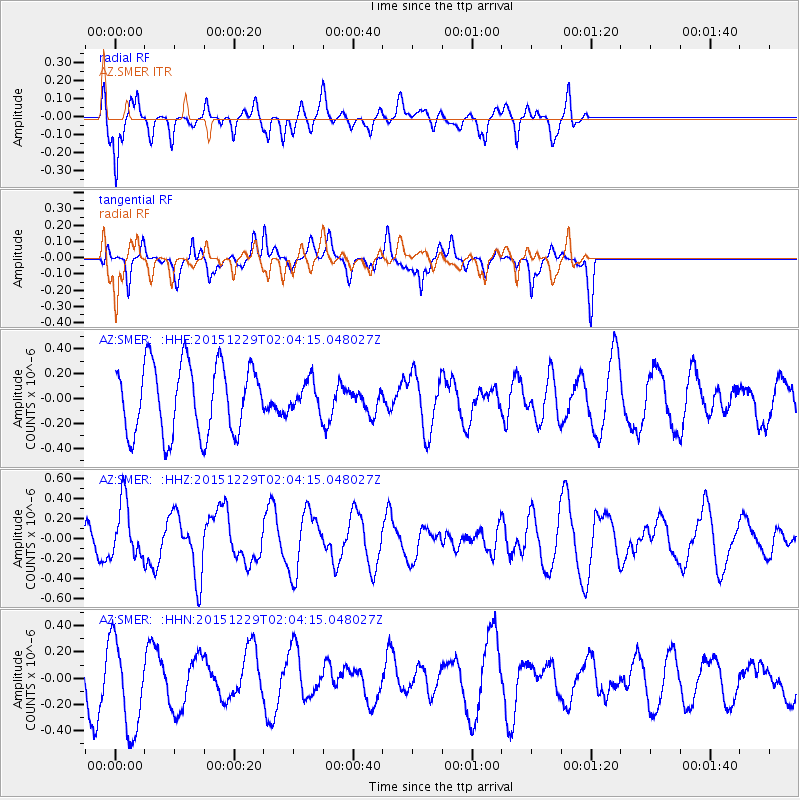
SMER AZ.SMER - Earthquake Result Viewer
*The percent match for this event was below the threshold and hence no stack was calculated.
| Earthquake location: |
Solomon Islands |
| Earthquake latitude/longitude: |
-6.3/154.6 |
| Earthquake time(UTC): |
2015/12/29 (363) 01:51:44 GMT |
| Earthquake Depth: |
47 km |
| Earthquake Magnitude: |
5.6 MB |
| Earthquake Catalog/Contributor: |
NEIC PDE/NEIC COMCAT |
|
| Network: |
AZ ANZA Regional Network |
| Station: |
SMER AZ.SMER |
| Lat/Lon: |
33.46 N/117.17 W |
| Elevation: |
355 m |
|
| Distance: |
91.9 deg |
| Az: |
56.725 deg |
| Baz: |
263.75 deg |
| Ray Param: |
$rayparam |
*The percent match for this event was below the threshold and hence was not used in the summary stack. |
|
| Radial Match: |
58.149403 % |
| Radial Bump: |
375 |
| Transverse Match: |
55.971375 % |
| Transverse Bump: |
400 |
| SOD ConfigId: |
7422571 |
| Insert Time: |
2019-04-21 16:05:04.557 +0000 |
| GWidth: |
2.5 |
| Max Bumps: |
400 |
| Tol: |
0.001 |
|
Signal To Noise
| Channel | StoN | STA | LTA |
| AZ:SMER: :HHZ:20151229T02:04:15.048027Z | 1.201296 | 2.849755E-7 | 2.3722338E-7 |
| AZ:SMER: :HHN:20151229T02:04:15.048027Z | 2.6799746 | 3.5185974E-7 | 1.312922E-7 |
| AZ:SMER: :HHE:20151229T02:04:15.048027Z | 0.58452684 | 1.6141723E-7 | 2.7615025E-7 |
| Arrivals |
| Ps | |
| PpPs | |
| PsPs/PpSs | |


