You are here: Home > Network List > CI - Caltech Regional Seismic Network Stations List
> Station SWS Sam W. Stewart, Westmorland, CA, USA > Earthquake Result Viewer
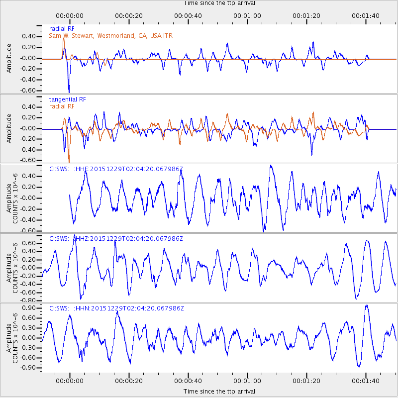
SWS Sam W. Stewart, Westmorland, CA, USA - Earthquake Result Viewer
*The percent match for this event was below the threshold and hence no stack was calculated.
| Earthquake location: |
Solomon Islands |
| Earthquake latitude/longitude: |
-6.3/154.6 |
| Earthquake time(UTC): |
2015/12/29 (363) 01:51:44 GMT |
| Earthquake Depth: |
47 km |
| Earthquake Magnitude: |
5.6 MB |
| Earthquake Catalog/Contributor: |
NEIC PDE/NEIC COMCAT |
|
| Network: |
CI Caltech Regional Seismic Network |
| Station: |
SWS Sam W. Stewart, Westmorland, CA, USA |
| Lat/Lon: |
32.94 N/115.80 W |
| Elevation: |
140 m |
|
| Distance: |
93.0 deg |
| Az: |
57.356 deg |
| Baz: |
264.472 deg |
| Ray Param: |
$rayparam |
*The percent match for this event was below the threshold and hence was not used in the summary stack. |
|
| Radial Match: |
64.170555 % |
| Radial Bump: |
400 |
| Transverse Match: |
75.11793 % |
| Transverse Bump: |
400 |
| SOD ConfigId: |
7422571 |
| Insert Time: |
2019-04-21 16:05:45.932 +0000 |
| GWidth: |
2.5 |
| Max Bumps: |
400 |
| Tol: |
0.001 |
|
Signal To Noise
| Channel | StoN | STA | LTA |
| CI:SWS: :HHZ:20151229T02:04:20.067986Z | 3.533402 | 4.997304E-7 | 1.4143039E-7 |
| CI:SWS: :HHN:20151229T02:04:20.067986Z | 1.4881107 | 4.3547547E-7 | 2.9263649E-7 |
| CI:SWS: :HHE:20151229T02:04:20.067986Z | 1.087334 | 2.214261E-7 | 2.0364129E-7 |
| Arrivals |
| Ps | |
| PpPs | |
| PsPs/PpSs | |


