You are here: Home > Network List > IC - New China Digital Seismograph Network Stations List
> Station LSA Tibet, China > Earthquake Result Viewer
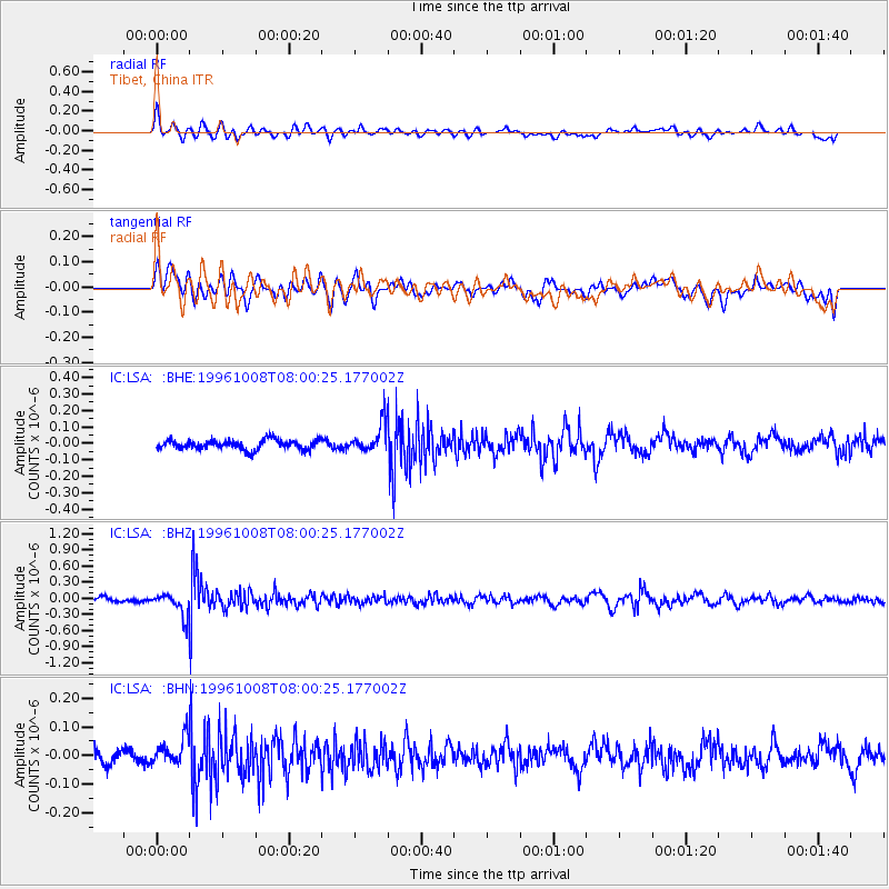
LSA Tibet, China - Earthquake Result Viewer
*The percent match for this event was below the threshold and hence no stack was calculated.
| Earthquake location: |
Northwest Of Kuril Islands |
| Earthquake latitude/longitude: |
52.9/152.5 |
| Earthquake time(UTC): |
1996/10/08 (282) 07:52:58 GMT |
| Earthquake Depth: |
627 km |
| Earthquake Magnitude: |
5.6 UNKNOWN, 5.2 MB |
| Earthquake Catalog/Contributor: |
WHDF/NEIC |
|
| Network: |
IC New China Digital Seismograph Network |
| Station: |
LSA Tibet, China |
| Lat/Lon: |
29.70 N/91.15 E |
| Elevation: |
3789 m |
|
| Distance: |
49.9 deg |
| Az: |
267.555 deg |
| Baz: |
44.111 deg |
| Ray Param: |
$rayparam |
*The percent match for this event was below the threshold and hence was not used in the summary stack. |
|
| Radial Match: |
59.272808 % |
| Radial Bump: |
400 |
| Transverse Match: |
60.79149 % |
| Transverse Bump: |
400 |
| SOD ConfigId: |
4480 |
| Insert Time: |
2010-03-04 22:57:36.718 +0000 |
| GWidth: |
2.5 |
| Max Bumps: |
400 |
| Tol: |
0.001 |
|
Signal To Noise
| Channel | StoN | STA | LTA |
| IC:LSA: :BHZ:19961008T08:00:25.177002Z | 3.0139248 | 2.014566E-7 | 6.684194E-8 |
| IC:LSA: :BHN:19961008T08:00:25.177002Z | 1.7634698 | 4.75419E-8 | 2.6959292E-8 |
| IC:LSA: :BHE:19961008T08:00:25.177002Z | 2.8773444 | 8.3761954E-8 | 2.9110852E-8 |
| Arrivals |
| Ps | |
| PpPs | |
| PsPs/PpSs | |


