You are here: Home > Network List > IC - New China Digital Seismograph Network Stations List
> Station LSA Tibet, China > Earthquake Result Viewer
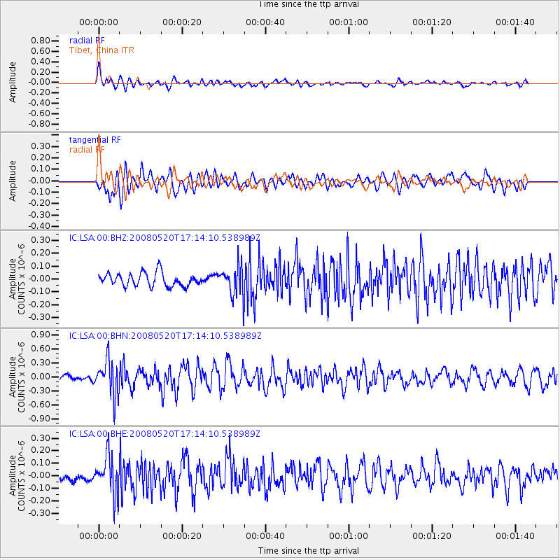
LSA Tibet, China - Earthquake Result Viewer
*The percent match for this event was below the threshold and hence no stack was calculated.
| Earthquake location: |
Southern Sumatra, Indonesia |
| Earthquake latitude/longitude: |
-3.2/101.5 |
| Earthquake time(UTC): |
2008/05/20 (141) 17:08:00 GMT |
| Earthquake Depth: |
48 km |
| Earthquake Magnitude: |
5.6 MB, 5.2 MS, 5.7 MW, 5.6 MW |
| Earthquake Catalog/Contributor: |
WHDF/NEIC |
|
| Network: |
IC New China Digital Seismograph Network |
| Station: |
LSA Tibet, China |
| Lat/Lon: |
29.70 N/91.15 E |
| Elevation: |
3789 m |
|
| Distance: |
34.2 deg |
| Az: |
343.875 deg |
| Baz: |
161.414 deg |
| Ray Param: |
$rayparam |
*The percent match for this event was below the threshold and hence was not used in the summary stack. |
|
| Radial Match: |
73.35564 % |
| Radial Bump: |
400 |
| Transverse Match: |
71.21464 % |
| Transverse Bump: |
400 |
| SOD ConfigId: |
2504 |
| Insert Time: |
2010-03-04 22:57:52.556 +0000 |
| GWidth: |
2.5 |
| Max Bumps: |
400 |
| Tol: |
0.001 |
|
Signal To Noise
| Channel | StoN | STA | LTA |
| IC:LSA:00:BHN:20080520T17:14:10.538989Z | 5.615529 | 3.8020497E-7 | 6.770599E-8 |
| IC:LSA:00:BHE:20080520T17:14:10.538989Z | 4.008808 | 1.5037963E-7 | 3.7512304E-8 |
| IC:LSA:00:BHZ:20080520T17:14:10.538989Z | 2.0338023 | 1.0448599E-7 | 5.1374702E-8 |
| Arrivals |
| Ps | |
| PpPs | |
| PsPs/PpSs | |


