You are here: Home > Network List > IC - New China Digital Seismograph Network Stations List
> Station LSA Tibet, China > Earthquake Result Viewer
LSA Tibet, China - Earthquake Result Viewer
*The percent match for this event was below the threshold and hence no stack was calculated.
| Earthquake location: |
Kuril Islands |
| Earthquake latitude/longitude: |
49.9/156.4 |
| Earthquake time(UTC): |
2008/08/04 (217) 04:42:14 GMT |
| Earthquake Depth: |
77 km |
| Earthquake Magnitude: |
5.6 MB, 5.8 MW, 5.7 MW |
| Earthquake Catalog/Contributor: |
WHDF/NEIC |
|
| Network: |
IC New China Digital Seismograph Network |
| Station: |
LSA Tibet, China |
| Lat/Lon: |
29.70 N/91.15 E |
| Elevation: |
3789 m |
|
| Distance: |
52.3 deg |
| Az: |
272.987 deg |
| Baz: |
47.984 deg |
| Ray Param: |
$rayparam |
*The percent match for this event was below the threshold and hence was not used in the summary stack. |
|
| Radial Match: |
71.37947 % |
| Radial Bump: |
400 |
| Transverse Match: |
70.35933 % |
| Transverse Bump: |
400 |
| SOD ConfigId: |
2504 |
| Insert Time: |
2010-03-04 22:58:04.819 +0000 |
| GWidth: |
2.5 |
| Max Bumps: |
400 |
| Tol: |
0.001 |
|
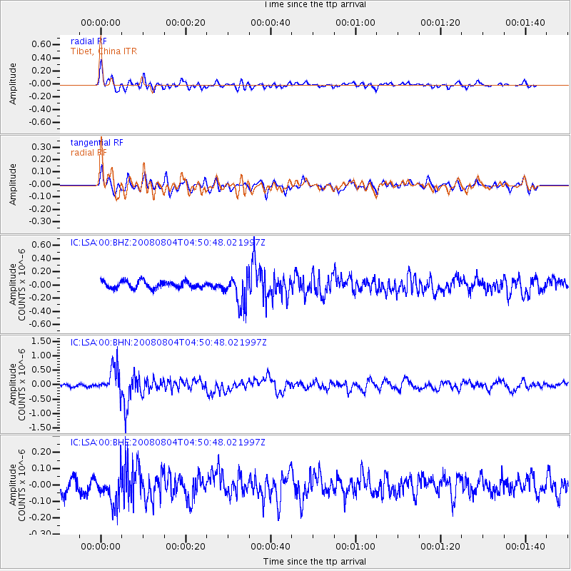
Signal To Noise
| Channel | StoN | STA | LTA |
| IC:LSA:00:BHN:20080804T04:50:48.021997Z | 10.407163 | 4.7617704E-7 | 4.5754742E-8 |
| IC:LSA:00:BHE:20080804T04:50:48.021997Z | 2.972401 | 9.681031E-8 | 3.2569737E-8 |
| IC:LSA:00:BHZ:20080804T04:50:48.021997Z | 4.306005 | 2.3092828E-7 | 5.362936E-8 |
| Arrivals |
| Ps | |
| PpPs | |
| PsPs/PpSs | |


