You are here: Home > Network List > IC - New China Digital Seismograph Network Stations List
> Station LSA Tibet, China > Earthquake Result Viewer
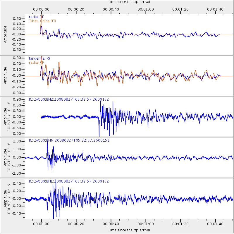
LSA Tibet, China - Earthquake Result Viewer
*The percent match for this event was below the threshold and hence no stack was calculated.
| Earthquake location: |
Kuril Islands |
| Earthquake latitude/longitude: |
46.7/152.5 |
| Earthquake time(UTC): |
2008/08/27 (240) 05:24:41 GMT |
| Earthquake Depth: |
65 km |
| Earthquake Magnitude: |
5.5 MB, 5.4 MW, 5.3 MW |
| Earthquake Catalog/Contributor: |
WHDF/NEIC |
|
| Network: |
IC New China Digital Seismograph Network |
| Station: |
LSA Tibet, China |
| Lat/Lon: |
29.70 N/91.15 E |
| Elevation: |
3789 m |
|
| Distance: |
49.8 deg |
| Az: |
272.715 deg |
| Baz: |
52.166 deg |
| Ray Param: |
$rayparam |
*The percent match for this event was below the threshold and hence was not used in the summary stack. |
|
| Radial Match: |
69.454124 % |
| Radial Bump: |
400 |
| Transverse Match: |
67.460655 % |
| Transverse Bump: |
400 |
| SOD ConfigId: |
2504 |
| Insert Time: |
2010-03-04 22:58:05.742 +0000 |
| GWidth: |
2.5 |
| Max Bumps: |
400 |
| Tol: |
0.001 |
|
Signal To Noise
| Channel | StoN | STA | LTA |
| IC:LSA:00:BHN:20080827T05:32:57.260015Z | 13.17264 | 5.668031E-7 | 4.3028816E-8 |
| IC:LSA:00:BHE:20080827T05:32:57.260015Z | 3.4197588 | 7.1807186E-8 | 2.0997733E-8 |
| IC:LSA:00:BHZ:20080827T05:32:57.260015Z | 7.156074 | 2.626686E-7 | 3.6705686E-8 |
| Arrivals |
| Ps | |
| PpPs | |
| PsPs/PpSs | |


