You are here: Home > Network List > G - GEOSCOPE Stations List
> Station INU Inuyama, Japan > Earthquake Result Viewer
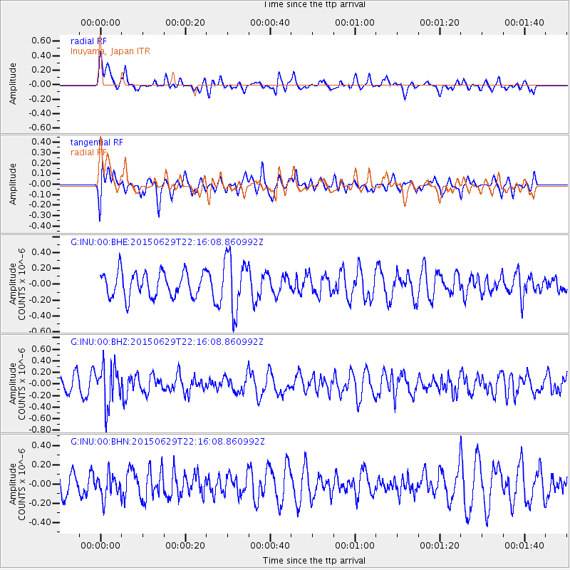
INU Inuyama, Japan - Earthquake Result Viewer
*The percent match for this event was below the threshold and hence no stack was calculated.
| Earthquake location: |
Afghanistan-Tajikistan Bord Reg. |
| Earthquake latitude/longitude: |
36.7/71.3 |
| Earthquake time(UTC): |
2015/06/29 (180) 22:07:48 GMT |
| Earthquake Depth: |
190 km |
| Earthquake Magnitude: |
5.5 MB |
| Earthquake Catalog/Contributor: |
NEIC PDE/NEIC ALERT |
|
| Network: |
G GEOSCOPE |
| Station: |
INU Inuyama, Japan |
| Lat/Lon: |
35.35 N/137.03 E |
| Elevation: |
132 m |
|
| Distance: |
52.2 deg |
| Az: |
70.552 deg |
| Baz: |
292.006 deg |
| Ray Param: |
$rayparam |
*The percent match for this event was below the threshold and hence was not used in the summary stack. |
|
| Radial Match: |
55.19832 % |
| Radial Bump: |
381 |
| Transverse Match: |
57.241493 % |
| Transverse Bump: |
400 |
| SOD ConfigId: |
976571 |
| Insert Time: |
2015-07-13 22:23:02.719 +0000 |
| GWidth: |
2.5 |
| Max Bumps: |
400 |
| Tol: |
0.001 |
|
Signal To Noise
| Channel | StoN | STA | LTA |
| G:INU:00:BHZ:20150629T22:16:08.860992Z | 2.1567843 | 3.413844E-7 | 1.5828398E-7 |
| G:INU:00:BHN:20150629T22:16:08.860992Z | 0.92424333 | 1.247853E-7 | 1.3501347E-7 |
| G:INU:00:BHE:20150629T22:16:08.860992Z | 2.2375364 | 3.4530868E-7 | 1.5432539E-7 |
| Arrivals |
| Ps | |
| PpPs | |
| PsPs/PpSs | |


