You are here: Home > Network List > IC - New China Digital Seismograph Network Stations List
> Station LSA Tibet, China > Earthquake Result Viewer
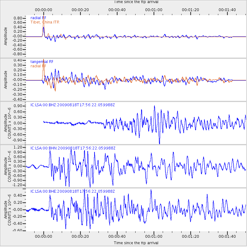
LSA Tibet, China - Earthquake Result Viewer
*The percent match for this event was below the threshold and hence no stack was calculated.
| Earthquake location: |
Southwest Of Sumatra, Indonesia |
| Earthquake latitude/longitude: |
-0.9/97.9 |
| Earthquake time(UTC): |
2009/08/18 (230) 17:50:34 GMT |
| Earthquake Depth: |
10 km |
| Earthquake Magnitude: |
5.5 MB, 5.5 MS, 5.9 MW |
| Earthquake Catalog/Contributor: |
WHDF/NEIC |
|
| Network: |
IC New China Digital Seismograph Network |
| Station: |
LSA Tibet, China |
| Lat/Lon: |
29.70 N/91.15 E |
| Elevation: |
3789 m |
|
| Distance: |
31.1 deg |
| Az: |
348.504 deg |
| Baz: |
166.76 deg |
| Ray Param: |
$rayparam |
*The percent match for this event was below the threshold and hence was not used in the summary stack. |
|
| Radial Match: |
74.717896 % |
| Radial Bump: |
400 |
| Transverse Match: |
69.86346 % |
| Transverse Bump: |
400 |
| SOD ConfigId: |
2622 |
| Insert Time: |
2010-03-04 22:58:24.029 +0000 |
| GWidth: |
2.5 |
| Max Bumps: |
400 |
| Tol: |
0.001 |
|
Signal To Noise
| Channel | StoN | STA | LTA |
| IC:LSA:00:BHN:20090818T17:56:22.059988Z | 6.0265317 | 3.617092E-7 | 6.001946E-8 |
| IC:LSA:00:BHE:20090818T17:56:22.059988Z | 5.5323606 | 1.4946109E-7 | 2.701579E-8 |
| IC:LSA:00:BHZ:20090818T17:56:22.059988Z | 2.4714406 | 1.0532248E-7 | 4.2615827E-8 |
| Arrivals |
| Ps | |
| PpPs | |
| PsPs/PpSs | |


