You are here: Home > Network List > CI - Caltech Regional Seismic Network Stations List
> Station MPM Manuel Prospect Mine, California, USA > Earthquake Result Viewer
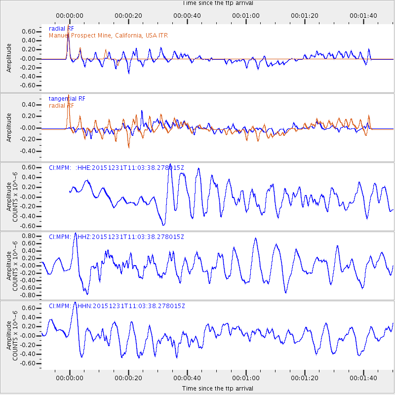
MPM Manuel Prospect Mine, California, USA - Earthquake Result Viewer
*The percent match for this event was below the threshold and hence no stack was calculated.
| Earthquake location: |
Near Coast Of Nicaragua |
| Earthquake latitude/longitude: |
11.2/-86.6 |
| Earthquake time(UTC): |
2015/12/31 (365) 10:57:00 GMT |
| Earthquake Depth: |
36 km |
| Earthquake Magnitude: |
5.7 MB |
| Earthquake Catalog/Contributor: |
NEIC PDE/NEIC COMCAT |
|
| Network: |
CI Caltech Regional Seismic Network |
| Station: |
MPM Manuel Prospect Mine, California, USA |
| Lat/Lon: |
36.06 N/117.49 W |
| Elevation: |
185 m |
|
| Distance: |
37.3 deg |
| Az: |
316.709 deg |
| Baz: |
123.86 deg |
| Ray Param: |
$rayparam |
*The percent match for this event was below the threshold and hence was not used in the summary stack. |
|
| Radial Match: |
44.832706 % |
| Radial Bump: |
400 |
| Transverse Match: |
60.915634 % |
| Transverse Bump: |
400 |
| SOD ConfigId: |
7422571 |
| Insert Time: |
2019-04-21 16:12:48.759 +0000 |
| GWidth: |
2.5 |
| Max Bumps: |
400 |
| Tol: |
0.001 |
|
Signal To Noise
| Channel | StoN | STA | LTA |
| CI:MPM: :HHZ:20151231T11:03:38.278015Z | 1.8862886 | 4.6195882E-7 | 2.449036E-7 |
| CI:MPM: :HHN:20151231T11:03:38.278015Z | 1.9382436 | 4.5794408E-7 | 2.3626757E-7 |
| CI:MPM: :HHE:20151231T11:03:38.278015Z | 3.0792894 | 4.4876822E-7 | 1.4573759E-7 |
| Arrivals |
| Ps | |
| PpPs | |
| PsPs/PpSs | |


