You are here: Home > Network List > CI - Caltech Regional Seismic Network Stations List
> Station MPP McPhearson Peak > Earthquake Result Viewer
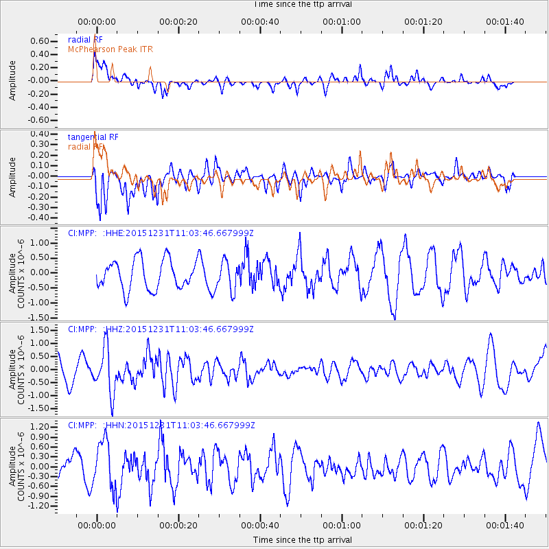
MPP McPhearson Peak - Earthquake Result Viewer
*The percent match for this event was below the threshold and hence no stack was calculated.
| Earthquake location: |
Near Coast Of Nicaragua |
| Earthquake latitude/longitude: |
11.2/-86.6 |
| Earthquake time(UTC): |
2015/12/31 (365) 10:57:00 GMT |
| Earthquake Depth: |
36 km |
| Earthquake Magnitude: |
5.7 MB |
| Earthquake Catalog/Contributor: |
NEIC PDE/NEIC COMCAT |
|
| Network: |
CI Caltech Regional Seismic Network |
| Station: |
MPP McPhearson Peak |
| Lat/Lon: |
34.89 N/119.81 W |
| Elevation: |
1739 m |
|
| Distance: |
38.3 deg |
| Az: |
313.457 deg |
| Baz: |
119.947 deg |
| Ray Param: |
$rayparam |
*The percent match for this event was below the threshold and hence was not used in the summary stack. |
|
| Radial Match: |
54.11258 % |
| Radial Bump: |
400 |
| Transverse Match: |
44.09037 % |
| Transverse Bump: |
359 |
| SOD ConfigId: |
7422571 |
| Insert Time: |
2019-04-21 16:12:49.559 +0000 |
| GWidth: |
2.5 |
| Max Bumps: |
400 |
| Tol: |
0.001 |
|
Signal To Noise
| Channel | StoN | STA | LTA |
| CI:MPP: :HHZ:20151231T11:03:46.667999Z | 2.4215918 | 8.843931E-7 | 3.652115E-7 |
| CI:MPP: :HHN:20151231T11:03:46.667999Z | 2.0487058 | 7.2145247E-7 | 3.5215035E-7 |
| CI:MPP: :HHE:20151231T11:03:46.667999Z | 0.9532931 | 4.724885E-7 | 4.9563823E-7 |
| Arrivals |
| Ps | |
| PpPs | |
| PsPs/PpSs | |


