You are here: Home > Network List > IC - New China Digital Seismograph Network Stations List
> Station LSA Tibet, China > Earthquake Result Viewer
LSA Tibet, China - Earthquake Result Viewer
*The percent match for this event was below the threshold and hence no stack was calculated.
| Earthquake location: |
Minahassa Peninsula, Sulawesi |
| Earthquake latitude/longitude: |
0.2/119.6 |
| Earthquake time(UTC): |
1998/05/21 (141) 05:34:25 GMT |
| Earthquake Depth: |
33 km |
| Earthquake Magnitude: |
6.2 MB, 6.3 MS, 6.6 UNKNOWN, 6.6 MW |
| Earthquake Catalog/Contributor: |
WHDF/NEIC |
|
| Network: |
IC New China Digital Seismograph Network |
| Station: |
LSA Tibet, China |
| Lat/Lon: |
29.70 N/91.15 E |
| Elevation: |
3789 m |
|
| Distance: |
39.9 deg |
| Az: |
319.798 deg |
| Baz: |
132.109 deg |
| Ray Param: |
$rayparam |
*The percent match for this event was below the threshold and hence was not used in the summary stack. |
|
| Radial Match: |
76.902626 % |
| Radial Bump: |
400 |
| Transverse Match: |
64.20411 % |
| Transverse Bump: |
400 |
| SOD ConfigId: |
4480 |
| Insert Time: |
2010-03-04 22:58:37.037 +0000 |
| GWidth: |
2.5 |
| Max Bumps: |
400 |
| Tol: |
0.001 |
|
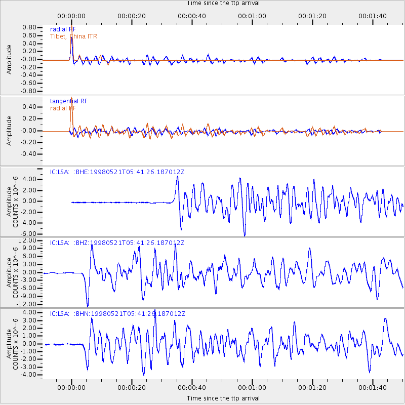
Signal To Noise
| Channel | StoN | STA | LTA |
| IC:LSA: :BHZ:19980521T05:41:26.187012Z | 19.265314 | 1.6884861E-6 | 8.764384E-8 |
| IC:LSA: :BHN:19980521T05:41:26.187012Z | 14.30626 | 4.5981994E-7 | 3.214117E-8 |
| IC:LSA: :BHE:19980521T05:41:26.187012Z | 22.450539 | 6.1964505E-7 | 2.7600453E-8 |
| Arrivals |
| Ps | |
| PpPs | |
| PsPs/PpSs | |


