You are here: Home > Network List > IC - New China Digital Seismograph Network Stations List
> Station LSA Tibet, China > Earthquake Result Viewer
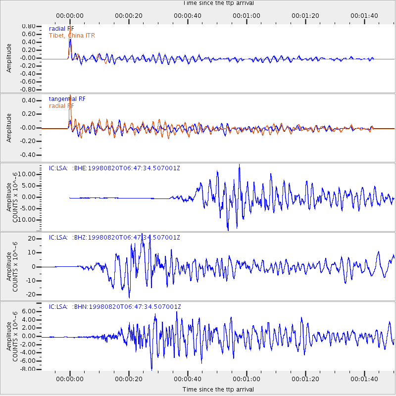
LSA Tibet, China - Earthquake Result Viewer
*The percent match for this event was below the threshold and hence no stack was calculated.
| Earthquake location: |
Bonin Islands, Japan Region |
| Earthquake latitude/longitude: |
28.9/139.3 |
| Earthquake time(UTC): |
1998/08/20 (232) 06:40:55 GMT |
| Earthquake Depth: |
441 km |
| Earthquake Magnitude: |
6.1 MB, 7.0 UNKNOWN, 7.0 MW |
| Earthquake Catalog/Contributor: |
WHDF/NEIC |
|
| Network: |
IC New China Digital Seismograph Network |
| Station: |
LSA Tibet, China |
| Lat/Lon: |
29.70 N/91.15 E |
| Elevation: |
3789 m |
|
| Distance: |
41.8 deg |
| Az: |
283.267 deg |
| Baz: |
78.693 deg |
| Ray Param: |
$rayparam |
*The percent match for this event was below the threshold and hence was not used in the summary stack. |
|
| Radial Match: |
70.87768 % |
| Radial Bump: |
400 |
| Transverse Match: |
74.79323 % |
| Transverse Bump: |
400 |
| SOD ConfigId: |
4480 |
| Insert Time: |
2010-03-04 22:59:05.541 +0000 |
| GWidth: |
2.5 |
| Max Bumps: |
400 |
| Tol: |
0.001 |
|
Signal To Noise
| Channel | StoN | STA | LTA |
| IC:LSA: :BHZ:19980820T06:47:34.507001Z | 5.5402193 | 6.148621E-7 | 1.10981546E-7 |
| IC:LSA: :BHN:19980820T06:47:34.507001Z | 2.1696615 | 6.805383E-8 | 3.1366106E-8 |
| IC:LSA: :BHE:19980820T06:47:34.507001Z | 5.8624387 | 2.8051394E-7 | 4.7849362E-8 |
| Arrivals |
| Ps | |
| PpPs | |
| PsPs/PpSs | |


