You are here: Home > Network List > TA - USArray Transportable Network (new EarthScope stations) Stations List
> Station J01E Myrtle Point, OR, USA > Earthquake Result Viewer
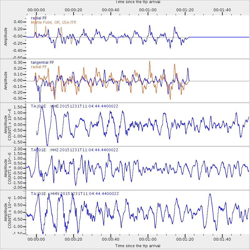
J01E Myrtle Point, OR, USA - Earthquake Result Viewer
*The percent match for this event was below the threshold and hence no stack was calculated.
| Earthquake location: |
Near Coast Of Nicaragua |
| Earthquake latitude/longitude: |
11.2/-86.6 |
| Earthquake time(UTC): |
2015/12/31 (365) 10:57:00 GMT |
| Earthquake Depth: |
36 km |
| Earthquake Magnitude: |
5.7 MB |
| Earthquake Catalog/Contributor: |
NEIC PDE/NEIC COMCAT |
|
| Network: |
TA USArray Transportable Network (new EarthScope stations) |
| Station: |
J01E Myrtle Point, OR, USA |
| Lat/Lon: |
43.16 N/123.93 W |
| Elevation: |
128 m |
|
| Distance: |
45.4 deg |
| Az: |
321.469 deg |
| Baz: |
123.342 deg |
| Ray Param: |
$rayparam |
*The percent match for this event was below the threshold and hence was not used in the summary stack. |
|
| Radial Match: |
67.54476 % |
| Radial Bump: |
352 |
| Transverse Match: |
38.61828 % |
| Transverse Bump: |
324 |
| SOD ConfigId: |
7422571 |
| Insert Time: |
2019-04-21 16:17:32.471 +0000 |
| GWidth: |
2.5 |
| Max Bumps: |
400 |
| Tol: |
0.001 |
|
Signal To Noise
| Channel | StoN | STA | LTA |
| TA:J01E: :HHZ:20151231T11:04:44.440002Z | 2.7237706 | 1.0693186E-6 | 3.9258762E-7 |
| TA:J01E: :HHN:20151231T11:04:44.440002Z | 2.5564814 | 8.8397036E-7 | 3.457762E-7 |
| TA:J01E: :HHE:20151231T11:04:44.440002Z | 0.50356406 | 4.3547183E-7 | 8.6477945E-7 |
| Arrivals |
| Ps | |
| PpPs | |
| PsPs/PpSs | |


