You are here: Home > Network List > TA - USArray Transportable Network (new EarthScope stations) Stations List
> Station J26L Joseph Creek, AK, USA > Earthquake Result Viewer
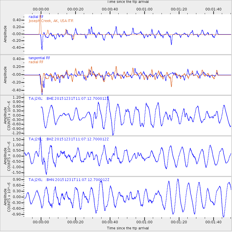
J26L Joseph Creek, AK, USA - Earthquake Result Viewer
*The percent match for this event was below the threshold and hence no stack was calculated.
| Earthquake location: |
Near Coast Of Nicaragua |
| Earthquake latitude/longitude: |
11.2/-86.6 |
| Earthquake time(UTC): |
2015/12/31 (365) 10:57:00 GMT |
| Earthquake Depth: |
36 km |
| Earthquake Magnitude: |
5.7 MB |
| Earthquake Catalog/Contributor: |
NEIC PDE/NEIC COMCAT |
|
| Network: |
TA USArray Transportable Network (new EarthScope stations) |
| Station: |
J26L Joseph Creek, AK, USA |
| Lat/Lon: |
64.50 N/143.56 W |
| Elevation: |
1144 m |
|
| Distance: |
66.1 deg |
| Az: |
336.623 deg |
| Baz: |
115.905 deg |
| Ray Param: |
$rayparam |
*The percent match for this event was below the threshold and hence was not used in the summary stack. |
|
| Radial Match: |
41.643597 % |
| Radial Bump: |
319 |
| Transverse Match: |
61.755344 % |
| Transverse Bump: |
400 |
| SOD ConfigId: |
7422571 |
| Insert Time: |
2019-04-21 16:17:34.018 +0000 |
| GWidth: |
2.5 |
| Max Bumps: |
400 |
| Tol: |
0.001 |
|
Signal To Noise
| Channel | StoN | STA | LTA |
| TA:J26L: :BHZ:20151231T11:07:12.700012Z | 2.5626504 | 9.295628E-7 | 3.6273494E-7 |
| TA:J26L: :BHN:20151231T11:07:12.700012Z | 0.9609871 | 3.4312785E-7 | 3.5705773E-7 |
| TA:J26L: :BHE:20151231T11:07:12.700012Z | 1.3892323 | 4.85907E-7 | 3.4976657E-7 |
| Arrivals |
| Ps | |
| PpPs | |
| PsPs/PpSs | |


