You are here: Home > Network List > US - United States National Seismic Network Stations List
> Station DGMT Dagmar, Montana, USA > Earthquake Result Viewer
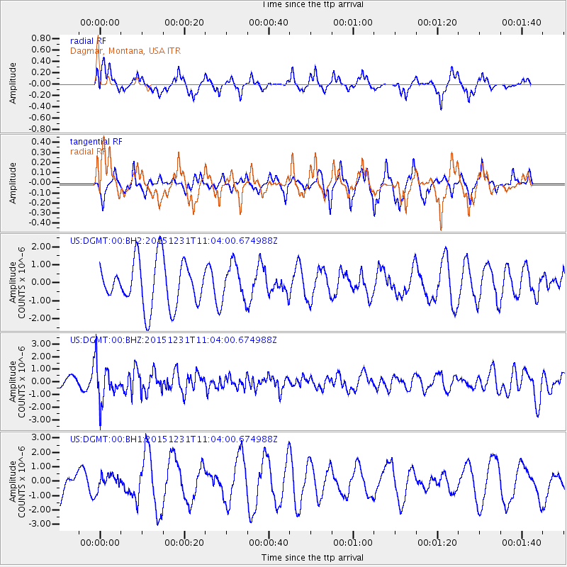
DGMT Dagmar, Montana, USA - Earthquake Result Viewer
*The percent match for this event was below the threshold and hence no stack was calculated.
| Earthquake location: |
Near Coast Of Nicaragua |
| Earthquake latitude/longitude: |
11.2/-86.6 |
| Earthquake time(UTC): |
2015/12/31 (365) 10:57:00 GMT |
| Earthquake Depth: |
36 km |
| Earthquake Magnitude: |
5.7 MB |
| Earthquake Catalog/Contributor: |
NEIC PDE/NEIC COMCAT |
|
| Network: |
US United States National Seismic Network |
| Station: |
DGMT Dagmar, Montana, USA |
| Lat/Lon: |
48.47 N/104.20 W |
| Elevation: |
0.0 m |
|
| Distance: |
40.0 deg |
| Az: |
341.789 deg |
| Baz: |
152.561 deg |
| Ray Param: |
$rayparam |
*The percent match for this event was below the threshold and hence was not used in the summary stack. |
|
| Radial Match: |
40.0874 % |
| Radial Bump: |
298 |
| Transverse Match: |
39.121147 % |
| Transverse Bump: |
257 |
| SOD ConfigId: |
7422571 |
| Insert Time: |
2019-04-21 16:18:03.587 +0000 |
| GWidth: |
2.5 |
| Max Bumps: |
400 |
| Tol: |
0.001 |
|
Signal To Noise
| Channel | StoN | STA | LTA |
| US:DGMT:00:BHZ:20151231T11:04:00.674988Z | 3.2949197 | 1.3960117E-6 | 4.236861E-7 |
| US:DGMT:00:BH1:20151231T11:04:00.674988Z | 0.3671374 | 4.675597E-7 | 1.2735278E-6 |
| US:DGMT:00:BH2:20151231T11:04:00.674988Z | 0.79830223 | 1.0059068E-6 | 1.2600576E-6 |
| Arrivals |
| Ps | |
| PpPs | |
| PsPs/PpSs | |


