You are here: Home > Network List > US - United States National Seismic Network Stations List
> Station ELK Elko, Nevada, USA > Earthquake Result Viewer
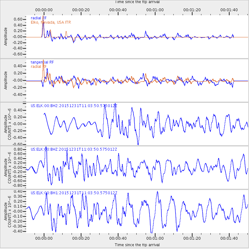
ELK Elko, Nevada, USA - Earthquake Result Viewer
*The percent match for this event was below the threshold and hence no stack was calculated.
| Earthquake location: |
Near Coast Of Nicaragua |
| Earthquake latitude/longitude: |
11.2/-86.6 |
| Earthquake time(UTC): |
2015/12/31 (365) 10:57:00 GMT |
| Earthquake Depth: |
36 km |
| Earthquake Magnitude: |
5.7 MB |
| Earthquake Catalog/Contributor: |
NEIC PDE/NEIC COMCAT |
|
| Network: |
US United States National Seismic Network |
| Station: |
ELK Elko, Nevada, USA |
| Lat/Lon: |
40.74 N/115.24 W |
| Elevation: |
2210 m |
|
| Distance: |
38.8 deg |
| Az: |
324.48 deg |
| Baz: |
131.379 deg |
| Ray Param: |
$rayparam |
*The percent match for this event was below the threshold and hence was not used in the summary stack. |
|
| Radial Match: |
61.0209 % |
| Radial Bump: |
280 |
| Transverse Match: |
64.40542 % |
| Transverse Bump: |
361 |
| SOD ConfigId: |
7422571 |
| Insert Time: |
2019-04-21 16:18:05.333 +0000 |
| GWidth: |
2.5 |
| Max Bumps: |
400 |
| Tol: |
0.001 |
|
Signal To Noise
| Channel | StoN | STA | LTA |
| US:ELK:00:BHZ:20151231T11:03:50.575012Z | 4.035323 | 5.163919E-7 | 1.2796791E-7 |
| US:ELK:00:BH1:20151231T11:03:50.575012Z | 0.8977859 | 1.938033E-7 | 2.1586807E-7 |
| US:ELK:00:BH2:20151231T11:03:50.575012Z | 2.1721387 | 2.8939098E-7 | 1.3322858E-7 |
| Arrivals |
| Ps | |
| PpPs | |
| PsPs/PpSs | |


