You are here: Home > Network List > US - United States National Seismic Network Stations List
> Station EGMT Eagleton, Montana, USA > Earthquake Result Viewer
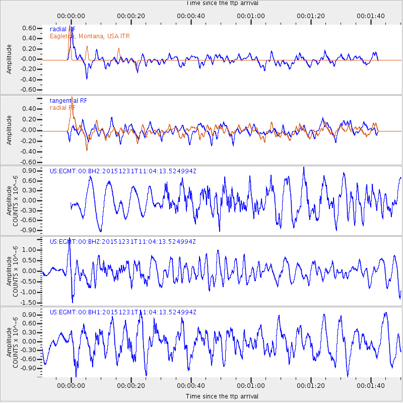
EGMT Eagleton, Montana, USA - Earthquake Result Viewer
*The percent match for this event was below the threshold and hence no stack was calculated.
| Earthquake location: |
Near Coast Of Nicaragua |
| Earthquake latitude/longitude: |
11.2/-86.6 |
| Earthquake time(UTC): |
2015/12/31 (365) 10:57:00 GMT |
| Earthquake Depth: |
36 km |
| Earthquake Magnitude: |
5.7 MB |
| Earthquake Catalog/Contributor: |
NEIC PDE/NEIC COMCAT |
|
| Network: |
US United States National Seismic Network |
| Station: |
EGMT Eagleton, Montana, USA |
| Lat/Lon: |
48.02 N/109.75 W |
| Elevation: |
1055 m |
|
| Distance: |
41.5 deg |
| Az: |
336.578 deg |
| Baz: |
144.475 deg |
| Ray Param: |
$rayparam |
*The percent match for this event was below the threshold and hence was not used in the summary stack. |
|
| Radial Match: |
52.479557 % |
| Radial Bump: |
400 |
| Transverse Match: |
54.21296 % |
| Transverse Bump: |
400 |
| SOD ConfigId: |
7422571 |
| Insert Time: |
2019-04-21 16:18:05.613 +0000 |
| GWidth: |
2.5 |
| Max Bumps: |
400 |
| Tol: |
0.001 |
|
Signal To Noise
| Channel | StoN | STA | LTA |
| US:EGMT:00:BHZ:20151231T11:04:13.524994Z | 6.061058 | 6.77367E-7 | 1.1175721E-7 |
| US:EGMT:00:BH1:20151231T11:04:13.524994Z | 1.5398906 | 4.934799E-7 | 3.2046424E-7 |
| US:EGMT:00:BH2:20151231T11:04:13.524994Z | 0.6014074 | 2.3732626E-7 | 3.9461813E-7 |
| Arrivals |
| Ps | |
| PpPs | |
| PsPs/PpSs | |


