You are here: Home > Network List > UW - Pacific Northwest Regional Seismic Network Stations List
> Station LCCR Mulino, OR, USA > Earthquake Result Viewer
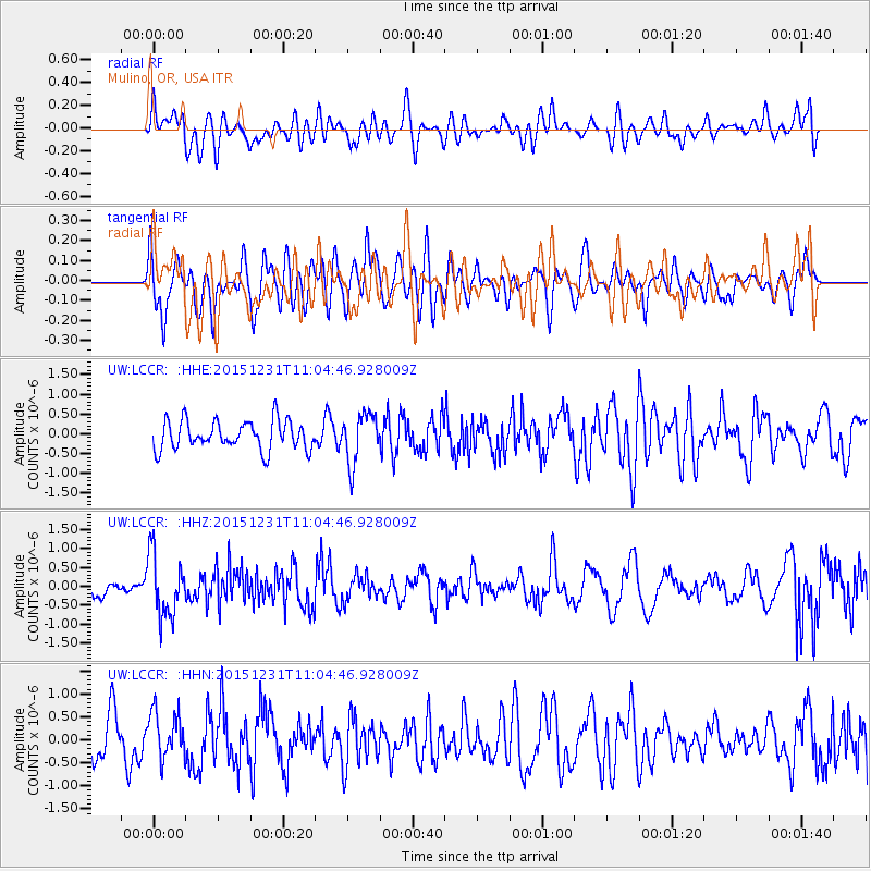
LCCR Mulino, OR, USA - Earthquake Result Viewer
*The percent match for this event was below the threshold and hence no stack was calculated.
| Earthquake location: |
Near Coast Of Nicaragua |
| Earthquake latitude/longitude: |
11.2/-86.6 |
| Earthquake time(UTC): |
2015/12/31 (365) 10:57:00 GMT |
| Earthquake Depth: |
36 km |
| Earthquake Magnitude: |
5.7 MB |
| Earthquake Catalog/Contributor: |
NEIC PDE/NEIC COMCAT |
|
| Network: |
UW Pacific Northwest Regional Seismic Network |
| Station: |
LCCR Mulino, OR, USA |
| Lat/Lon: |
45.21 N/122.48 W |
| Elevation: |
273 m |
|
| Distance: |
45.7 deg |
| Az: |
324.656 deg |
| Baz: |
126.584 deg |
| Ray Param: |
$rayparam |
*The percent match for this event was below the threshold and hence was not used in the summary stack. |
|
| Radial Match: |
48.132767 % |
| Radial Bump: |
400 |
| Transverse Match: |
61.112297 % |
| Transverse Bump: |
400 |
| SOD ConfigId: |
7422571 |
| Insert Time: |
2019-04-21 16:18:45.587 +0000 |
| GWidth: |
2.5 |
| Max Bumps: |
400 |
| Tol: |
0.001 |
|
Signal To Noise
| Channel | StoN | STA | LTA |
| UW:LCCR: :HHZ:20151231T11:04:46.928009Z | 2.6948776 | 8.177219E-7 | 3.0343563E-7 |
| UW:LCCR: :HHN:20151231T11:04:46.928009Z | 1.408043 | 5.026926E-7 | 3.5701507E-7 |
| UW:LCCR: :HHE:20151231T11:04:46.928009Z | 1.740534 | 6.311138E-7 | 3.625978E-7 |
| Arrivals |
| Ps | |
| PpPs | |
| PsPs/PpSs | |


