MDJ Mudanjiang, Heilongjiang Province, China - Earthquake Result Viewer
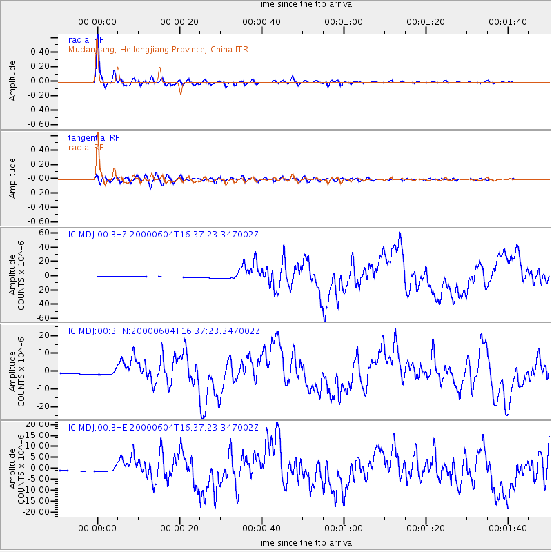
Earthquake location: Southern Sumatra, Indonesia
Earthquake latitude/longitude: -4.7/102.1
Earthquake time(UTC): 2000/06/04 (156) 16:28:26 GMT
Earthquake Depth: 33 km
Earthquake Magnitude: 6.8 MB, 8.0 MS, 7.9 MW, 7.7 MW
Earthquake Catalog/Contributor: WHDF/NEIC
Network: IC New China Digital Seismograph Network
Station: MDJ Mudanjiang, Heilongjiang Province, China
Lat/Lon: 44.62 N/129.59 E
Elevation: 250 m
Distance: 55.0 deg
Az: 23.755 deg
Baz: 214.205 deg
Ray Param: 0.06504758
Estimated Moho Depth: 32.5 km
Estimated Crust Vp/Vs: 1.76
Assumed Crust Vp: 6.459 km/s
Estimated Crust Vs: 3.665 km/s
Estimated Crust Poisson's Ratio: 0.26
Radial Match: 97.50155 %
Radial Bump: 357
Transverse Match: 78.20078 %
Transverse Bump: 400
SOD ConfigId: 3744
Insert Time: 2010-03-04 23:00:46.845 +0000
GWidth: 2.5
Max Bumps: 400
Tol: 0.001

Signal To Noise

ChannelStoNSTALTA
IC:MDJ:00:BHN:20000604T16:37:23.347002Z3.98397371.3524941E-63.394837E-7
IC:MDJ:00:BHE:20000604T16:37:23.347002Z4.14247851.091343E-62.634517E-7
IC:MDJ:00:BHZ:20000604T16:37:23.347002Z5.15880543.6980312E-67.1683866E-7
Arrivals
Ps4.0 SECOND
PpPs13 SECOND
PsPs/PpSs17 SECOND