You are here: Home > Network List > TA - USArray Transportable Network (new EarthScope stations) Stations List
> Station J25K Salcha River, AK, USA > Earthquake Result Viewer
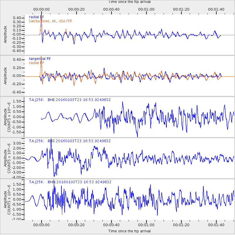
J25K Salcha River, AK, USA - Earthquake Result Viewer
*The percent match for this event was below the threshold and hence no stack was calculated.
| Earthquake location: |
Myanmar-India Border Region |
| Earthquake latitude/longitude: |
24.8/93.7 |
| Earthquake time(UTC): |
2016/01/03 (003) 23:05:22 GMT |
| Earthquake Depth: |
55 km |
| Earthquake Magnitude: |
6.7 MWW, 6.6 MWB |
| Earthquake Catalog/Contributor: |
NEIC PDE/NEIC COMCAT |
|
| Network: |
TA USArray Transportable Network (new EarthScope stations) |
| Station: |
J25K Salcha River, AK, USA |
| Lat/Lon: |
64.61 N/145.37 W |
| Elevation: |
949 m |
|
| Distance: |
79.9 deg |
| Az: |
22.05 deg |
| Baz: |
307.695 deg |
| Ray Param: |
$rayparam |
*The percent match for this event was below the threshold and hence was not used in the summary stack. |
|
| Radial Match: |
72.57218 % |
| Radial Bump: |
400 |
| Transverse Match: |
60.009758 % |
| Transverse Bump: |
400 |
| SOD ConfigId: |
7422571 |
| Insert Time: |
2019-04-21 16:45:18.144 +0000 |
| GWidth: |
2.5 |
| Max Bumps: |
400 |
| Tol: |
0.001 |
|
Signal To Noise
| Channel | StoN | STA | LTA |
| TA:J25K: :BHZ:20160103T23:16:53.924983Z | 4.0992203 | 1.0761306E-6 | 2.625208E-7 |
| TA:J25K: :BHN:20160103T23:16:53.924983Z | 3.892504 | 5.271368E-7 | 1.3542358E-7 |
| TA:J25K: :BHE:20160103T23:16:53.924983Z | 2.0501478 | 5.1983864E-7 | 2.5356152E-7 |
| Arrivals |
| Ps | |
| PpPs | |
| PsPs/PpSs | |


