You are here: Home > Network List > TA - USArray Transportable Network (new EarthScope stations) Stations List
> Station M22K Willow, AK, USA > Earthquake Result Viewer
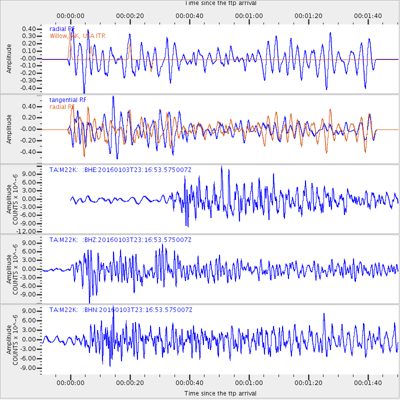
M22K Willow, AK, USA - Earthquake Result Viewer
*The percent match for this event was below the threshold and hence no stack was calculated.
| Earthquake location: |
Myanmar-India Border Region |
| Earthquake latitude/longitude: |
24.8/93.7 |
| Earthquake time(UTC): |
2016/01/03 (003) 23:05:22 GMT |
| Earthquake Depth: |
55 km |
| Earthquake Magnitude: |
6.7 MWW, 6.6 MWB |
| Earthquake Catalog/Contributor: |
NEIC PDE/NEIC COMCAT |
|
| Network: |
TA USArray Transportable Network (new EarthScope stations) |
| Station: |
M22K Willow, AK, USA |
| Lat/Lon: |
61.75 N/150.12 W |
| Elevation: |
57 m |
|
| Distance: |
79.8 deg |
| Az: |
25.694 deg |
| Baz: |
304.1 deg |
| Ray Param: |
$rayparam |
*The percent match for this event was below the threshold and hence was not used in the summary stack. |
|
| Radial Match: |
49.91696 % |
| Radial Bump: |
400 |
| Transverse Match: |
70.38976 % |
| Transverse Bump: |
400 |
| SOD ConfigId: |
7422571 |
| Insert Time: |
2019-04-21 16:45:24.857 +0000 |
| GWidth: |
2.5 |
| Max Bumps: |
400 |
| Tol: |
0.001 |
|
Signal To Noise
| Channel | StoN | STA | LTA |
| TA:M22K: :BHZ:20160103T23:16:53.575007Z | 6.8809214 | 2.5114937E-6 | 3.649938E-7 |
| TA:M22K: :BHN:20160103T23:16:53.575007Z | 0.9683051 | 8.94402E-7 | 9.236779E-7 |
| TA:M22K: :BHE:20160103T23:16:53.575007Z | 1.7967298 | 1.240391E-6 | 6.9036037E-7 |
| Arrivals |
| Ps | |
| PpPs | |
| PsPs/PpSs | |


