You are here: Home > Network List > II - Global Seismograph Network (GSN - IRIS/IDA) Stations List
> Station WRAB Tennant Creek, NT, Australia > Earthquake Result Viewer
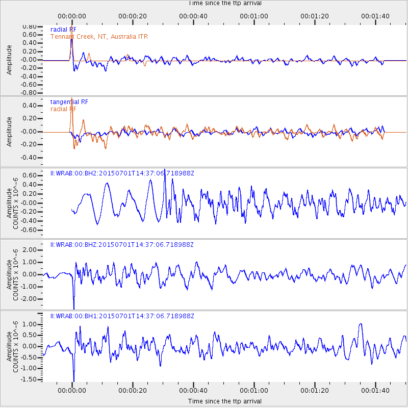
WRAB Tennant Creek, NT, Australia - Earthquake Result Viewer
*The percent match for this event was below the threshold and hence no stack was calculated.
| Earthquake location: |
Macquarie Island Region |
| Earthquake latitude/longitude: |
-52.2/159.6 |
| Earthquake time(UTC): |
2015/07/01 (182) 14:30:21 GMT |
| Earthquake Depth: |
10 km |
| Earthquake Magnitude: |
5.7 MB |
| Earthquake Catalog/Contributor: |
NEIC PDE/NEIC ALERT |
|
| Network: |
II Global Seismograph Network (GSN - IRIS/IDA) |
| Station: |
WRAB Tennant Creek, NT, Australia |
| Lat/Lon: |
19.93 S/134.36 E |
| Elevation: |
366 m |
|
| Distance: |
37.7 deg |
| Az: |
319.039 deg |
| Baz: |
154.613 deg |
| Ray Param: |
$rayparam |
*The percent match for this event was below the threshold and hence was not used in the summary stack. |
|
| Radial Match: |
66.71537 % |
| Radial Bump: |
400 |
| Transverse Match: |
48.895535 % |
| Transverse Bump: |
400 |
| SOD ConfigId: |
976571 |
| Insert Time: |
2015-07-15 15:00:24.092 +0000 |
| GWidth: |
2.5 |
| Max Bumps: |
400 |
| Tol: |
0.001 |
|
Signal To Noise
| Channel | StoN | STA | LTA |
| II:WRAB:00:BHZ:20150701T14:37:06.718988Z | 2.204511 | 8.173838E-7 | 3.7077783E-7 |
| II:WRAB:00:BH1:20150701T14:37:06.718988Z | 2.0727065 | 5.0890833E-7 | 2.455284E-7 |
| II:WRAB:00:BH2:20150701T14:37:06.718988Z | 1.3929845 | 3.125733E-7 | 2.2439106E-7 |
| Arrivals |
| Ps | |
| PpPs | |
| PsPs/PpSs | |


