You are here: Home > Network List > IU - Global Seismograph Network (GSN - IRIS/USGS) Stations List
> Station PMG Port Moresby, New Guinea > Earthquake Result Viewer
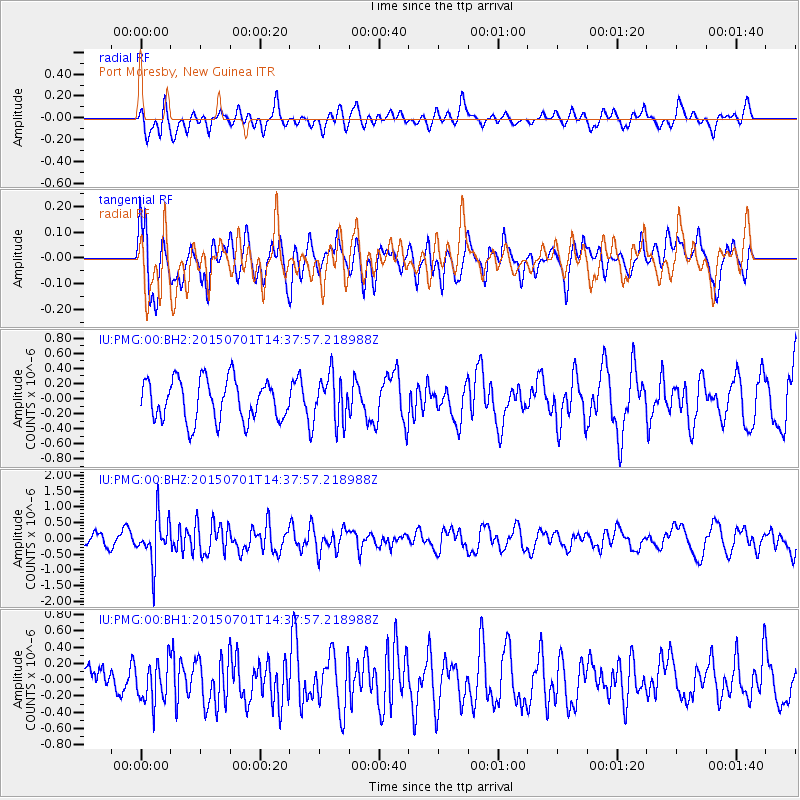
PMG Port Moresby, New Guinea - Earthquake Result Viewer
*The percent match for this event was below the threshold and hence no stack was calculated.
| Earthquake location: |
Macquarie Island Region |
| Earthquake latitude/longitude: |
-52.2/159.6 |
| Earthquake time(UTC): |
2015/07/01 (182) 14:30:21 GMT |
| Earthquake Depth: |
10 km |
| Earthquake Magnitude: |
5.7 MB |
| Earthquake Catalog/Contributor: |
NEIC PDE/NEIC ALERT |
|
| Network: |
IU Global Seismograph Network (GSN - IRIS/USGS) |
| Station: |
PMG Port Moresby, New Guinea |
| Lat/Lon: |
9.40 S/147.16 E |
| Elevation: |
90 m |
|
| Distance: |
43.9 deg |
| Az: |
342.13 deg |
| Baz: |
168.968 deg |
| Ray Param: |
$rayparam |
*The percent match for this event was below the threshold and hence was not used in the summary stack. |
|
| Radial Match: |
60.553917 % |
| Radial Bump: |
400 |
| Transverse Match: |
42.615597 % |
| Transverse Bump: |
400 |
| SOD ConfigId: |
976571 |
| Insert Time: |
2015-07-15 15:00:50.427 +0000 |
| GWidth: |
2.5 |
| Max Bumps: |
400 |
| Tol: |
0.001 |
|
Signal To Noise
| Channel | StoN | STA | LTA |
| IU:PMG:00:BHZ:20150701T14:37:57.218988Z | 3.6055875 | 7.240588E-7 | 2.0081575E-7 |
| IU:PMG:00:BH1:20150701T14:37:57.218988Z | 0.73260427 | 2.4725E-7 | 3.374946E-7 |
| IU:PMG:00:BH2:20150701T14:37:57.218988Z | 1.1288549 | 3.028215E-7 | 2.6825546E-7 |
| Arrivals |
| Ps | |
| PpPs | |
| PsPs/PpSs | |


