You are here: Home > Network List > KN - Kyrgyz Seismic Telemetry Network Stations List
> Station CHM KN.CHM > Earthquake Result Viewer
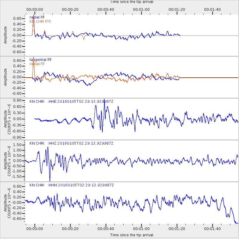
CHM KN.CHM - Earthquake Result Viewer
*The percent match for this event was below the threshold and hence no stack was calculated.
| Earthquake location: |
Southeast Of Shikoku, Japan |
| Earthquake latitude/longitude: |
30.6/132.8 |
| Earthquake time(UTC): |
2016/01/05 (005) 02:21:12 GMT |
| Earthquake Depth: |
10 km |
| Earthquake Magnitude: |
5.8 MB, 5.8 MWB |
| Earthquake Catalog/Contributor: |
NEIC PDE/NEIC COMCAT |
|
| Network: |
KN Kyrgyz Seismic Telemetry Network |
| Station: |
CHM KN.CHM |
| Lat/Lon: |
43.00 N/74.75 E |
| Elevation: |
655 m |
|
| Distance: |
47.2 deg |
| Az: |
301.986 deg |
| Baz: |
85.143 deg |
| Ray Param: |
$rayparam |
*The percent match for this event was below the threshold and hence was not used in the summary stack. |
|
| Radial Match: |
75.46635 % |
| Radial Bump: |
400 |
| Transverse Match: |
24.28014 % |
| Transverse Bump: |
400 |
| SOD ConfigId: |
7422571 |
| Insert Time: |
2019-04-21 16:49:59.727 +0000 |
| GWidth: |
2.5 |
| Max Bumps: |
400 |
| Tol: |
0.001 |
|
Signal To Noise
| Channel | StoN | STA | LTA |
| KN:CHM: :HHZ:20160105T02:29:13.929987Z | 10.500893 | 5.6661014E-7 | 5.395828E-8 |
| KN:CHM: :HHN:20160105T02:29:13.929987Z | 2.8365178 | 2.55648E-7 | 9.0127415E-8 |
| KN:CHM: :HHE:20160105T02:29:13.929987Z | 5.075386 | 3.1815264E-7 | 6.268541E-8 |
| Arrivals |
| Ps | |
| PpPs | |
| PsPs/PpSs | |


