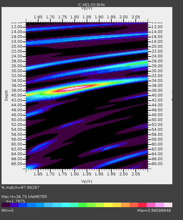
MDJ Mudanjiang, Heilongjiang Province, China - Earthquake Result Viewer
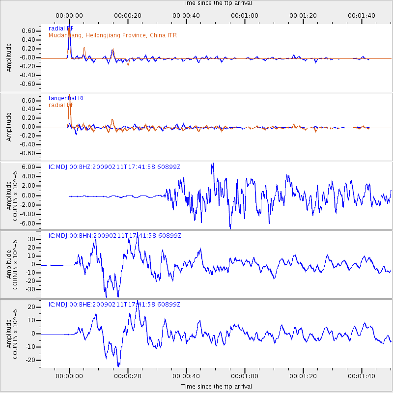
Earthquake location: Talaud Islands, Indonesia
Earthquake latitude/longitude: 3.9/126.4
Earthquake time(UTC): 2009/02/11 (042) 17:34:50 GMT
Earthquake Depth: 22 km
Earthquake Magnitude: 6.6 MB, 7.2 MS, 7.2 MW, 7.1 MW
Earthquake Catalog/Contributor: WHDF/NEIC
Network: IC New China Digital Seismograph Network
Station: MDJ Mudanjiang, Heilongjiang Province, China
Lat/Lon: 44.62 N/129.59 E
Elevation: 250 m
Distance: 40.7 deg
Az: 3.502 deg
Baz: 184.895 deg
Ray Param: 0.0742376
Estimated Moho Depth: 36.75 km
Estimated Crust Vp/Vs: 1.80
Assumed Crust Vp: 6.459 km/s
Estimated Crust Vs: 3.594 km/s
Estimated Crust Poisson's Ratio: 0.28
Radial Match: 97.98297 %
Radial Bump: 314
Transverse Match: 90.29247 %
Transverse Bump: 400
SOD ConfigId: 2658
Insert Time: 2010-03-04 23:04:29.683 +0000
GWidth: 2.5
Max Bumps: 400
Tol: 0.001

Signal To Noise

ChannelStoNSTALTA
IC:MDJ:00:BHN:20090211T17:41:58.60899Z39.836274.2444835E-61.06548214E-7
IC:MDJ:00:BHE:20090211T17:41:58.60899Z22.0767752.065039E-69.353898E-8
IC:MDJ:00:BHZ:20090211T17:41:58.60899Z5.38408955.796665E-71.0766287E-7
Arrivals
Ps4.9 SECOND
PpPs15 SECOND
PsPs/PpSs20 SECOND