You are here: Home > Network List > AZ - ANZA Regional Network Stations List
> Station LVA2 AZ.LVA2 > Earthquake Result Viewer
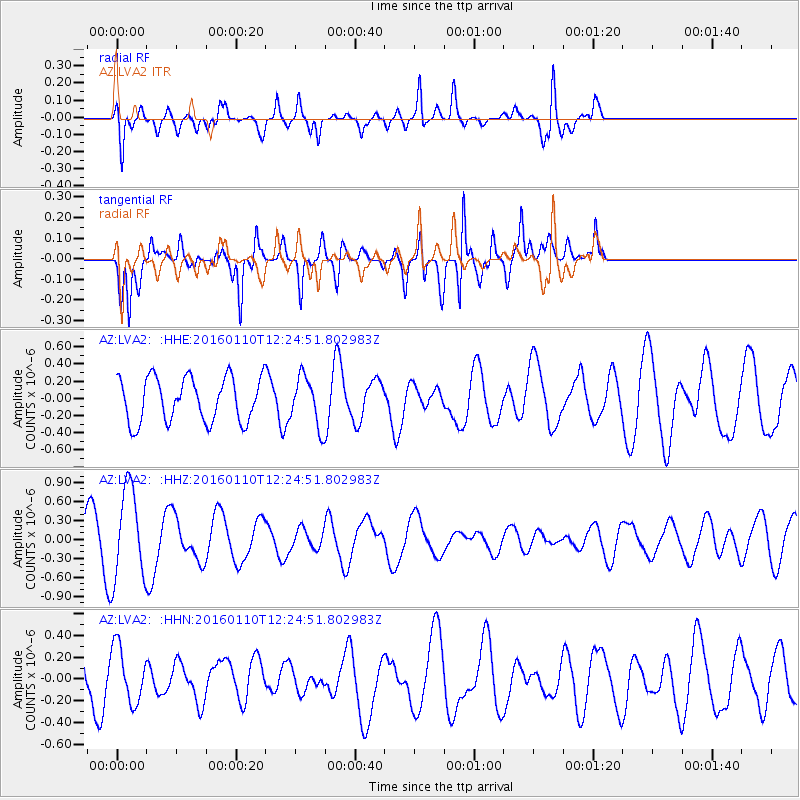
LVA2 AZ.LVA2 - Earthquake Result Viewer
*The percent match for this event was below the threshold and hence no stack was calculated.
| Earthquake location: |
Pacific-Antarctic Ridge |
| Earthquake latitude/longitude: |
-57.7/-147.9 |
| Earthquake time(UTC): |
2016/01/10 (010) 12:12:02 GMT |
| Earthquake Depth: |
4.0 km |
| Earthquake Magnitude: |
5.6 mwb |
| Earthquake Catalog/Contributor: |
NEIC PDE/us |
|
| Network: |
AZ ANZA Regional Network |
| Station: |
LVA2 AZ.LVA2 |
| Lat/Lon: |
33.35 N/116.56 W |
| Elevation: |
1435 m |
|
| Distance: |
94.4 deg |
| Az: |
25.928 deg |
| Baz: |
196.308 deg |
| Ray Param: |
$rayparam |
*The percent match for this event was below the threshold and hence was not used in the summary stack. |
|
| Radial Match: |
52.399097 % |
| Radial Bump: |
358 |
| Transverse Match: |
55.81355 % |
| Transverse Bump: |
400 |
| SOD ConfigId: |
7422571 |
| Insert Time: |
2019-04-21 17:14:04.766 +0000 |
| GWidth: |
2.5 |
| Max Bumps: |
400 |
| Tol: |
0.001 |
|
Signal To Noise
| Channel | StoN | STA | LTA |
| AZ:LVA2: :HHZ:20160110T12:24:51.802983Z | 2.5068893 | 7.171427E-7 | 2.8606877E-7 |
| AZ:LVA2: :HHN:20160110T12:24:51.802983Z | 1.194761 | 2.5866444E-7 | 2.164989E-7 |
| AZ:LVA2: :HHE:20160110T12:24:51.802983Z | 1.1152196 | 2.8589452E-7 | 2.5635717E-7 |
| Arrivals |
| Ps | |
| PpPs | |
| PsPs/PpSs | |


