You are here: Home > Network List > G - GEOSCOPE Stations List
> Station MPG Montagne des Peres, French Guyana > Earthquake Result Viewer
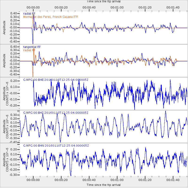
MPG Montagne des Peres, French Guyana - Earthquake Result Viewer
*The percent match for this event was below the threshold and hence no stack was calculated.
| Earthquake location: |
Pacific-Antarctic Ridge |
| Earthquake latitude/longitude: |
-57.7/-147.9 |
| Earthquake time(UTC): |
2016/01/10 (010) 12:12:02 GMT |
| Earthquake Depth: |
4.0 km |
| Earthquake Magnitude: |
5.6 mwb |
| Earthquake Catalog/Contributor: |
NEIC PDE/us |
|
| Network: |
G GEOSCOPE |
| Station: |
MPG Montagne des Peres, French Guyana |
| Lat/Lon: |
5.11 N/52.64 W |
| Elevation: |
147 m |
|
| Distance: |
97.1 deg |
| Az: |
91.738 deg |
| Baz: |
212.644 deg |
| Ray Param: |
$rayparam |
*The percent match for this event was below the threshold and hence was not used in the summary stack. |
|
| Radial Match: |
56.445377 % |
| Radial Bump: |
400 |
| Transverse Match: |
57.206882 % |
| Transverse Bump: |
400 |
| SOD ConfigId: |
7422571 |
| Insert Time: |
2019-04-21 17:15:08.674 +0000 |
| GWidth: |
2.5 |
| Max Bumps: |
400 |
| Tol: |
0.001 |
|
Signal To Noise
| Channel | StoN | STA | LTA |
| G:MPG:00:BHZ:20160110T12:25:04.000005Z | 0.7697134 | 1.121155E-7 | 1.4565876E-7 |
| G:MPG:00:BHN:20160110T12:25:04.000005Z | 0.88389784 | 8.165573E-8 | 9.2381406E-8 |
| G:MPG:00:BHE:20160110T12:25:04.000005Z | 1.0519911 | 1.0726387E-7 | 1.0196271E-7 |
| Arrivals |
| Ps | |
| PpPs | |
| PsPs/PpSs | |


