
MDJ Mudanjiang, Heilongjiang Province, China - Earthquake Result Viewer
| ||||||||||||||||||
| ||||||||||||||||||
| ||||||||||||||||||
|
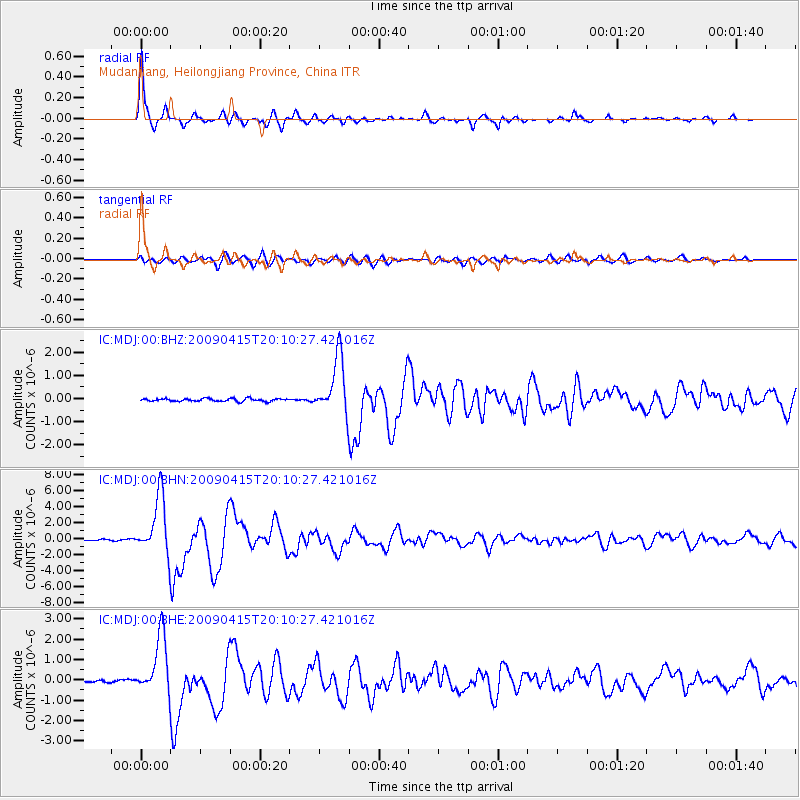
Signal To Noise
| Channel | StoN | STA | LTA |
| IC:MDJ:00:BHN:20090415T20:10:27.421016Z | 40.413254 | 3.6661515E-6 | 9.071657E-8 |
| IC:MDJ:00:BHE:20090415T20:10:27.421016Z | 25.471115 | 1.4490587E-6 | 5.6890272E-8 |
| IC:MDJ:00:BHZ:20090415T20:10:27.421016Z | 20.014902 | 1.2240329E-6 | 6.115608E-8 |
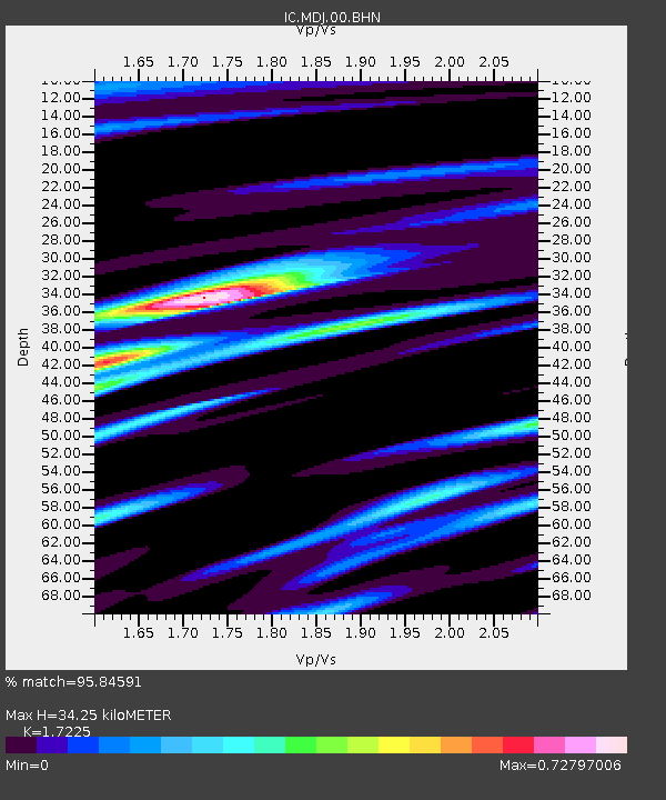
| Arrivals | |
| Ps | 4.0 SECOND |
| PpPs | 14 SECOND |
| PsPs/PpSs | 18 SECOND |

