You are here: Home > Network List > CI - Caltech Regional Seismic Network Stations List
> Station TIN Tinemaha, Big Pine, CA, USA > Earthquake Result Viewer
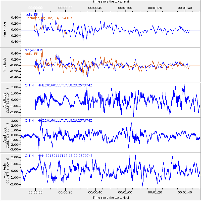
TIN Tinemaha, Big Pine, CA, USA - Earthquake Result Viewer
*The percent match for this event was below the threshold and hence no stack was calculated.
| Earthquake location: |
Hokkaido, Japan Region |
| Earthquake latitude/longitude: |
44.5/141.1 |
| Earthquake time(UTC): |
2016/01/11 (011) 17:08:03 GMT |
| Earthquake Depth: |
240 km |
| Earthquake Magnitude: |
6.2 MWW |
| Earthquake Catalog/Contributor: |
NEIC PDE/NEIC COMCAT |
|
| Network: |
CI Caltech Regional Seismic Network |
| Station: |
TIN Tinemaha, Big Pine, CA, USA |
| Lat/Lon: |
37.05 N/118.23 W |
| Elevation: |
1197 m |
|
| Distance: |
71.8 deg |
| Az: |
55.85 deg |
| Baz: |
312.209 deg |
| Ray Param: |
$rayparam |
*The percent match for this event was below the threshold and hence was not used in the summary stack. |
|
| Radial Match: |
63.899464 % |
| Radial Bump: |
400 |
| Transverse Match: |
63.851604 % |
| Transverse Bump: |
400 |
| SOD ConfigId: |
7422571 |
| Insert Time: |
2019-04-21 17:25:27.215 +0000 |
| GWidth: |
2.5 |
| Max Bumps: |
400 |
| Tol: |
0.001 |
|
Signal To Noise
| Channel | StoN | STA | LTA |
| CI:TIN: :HHZ:20160111T17:18:29.257974Z | 3.4609938 | 1.4593624E-6 | 4.2165993E-7 |
| CI:TIN: :HHN:20160111T17:18:29.257974Z | 1.7856133 | 9.991089E-7 | 5.595326E-7 |
| CI:TIN: :HHE:20160111T17:18:29.257974Z | 1.5013967 | 7.9766505E-7 | 5.31282E-7 |
| Arrivals |
| Ps | |
| PpPs | |
| PsPs/PpSs | |


