MDJ Mudanjiang, Heilongjiang Province, China - Earthquake Result Viewer
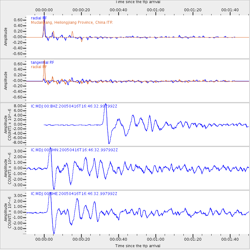
Earthquake location: Northern Sumatra, Indonesia
Earthquake latitude/longitude: 1.8/97.7
Earthquake time(UTC): 2005/04/16 (106) 16:38:03 GMT
Earthquake Depth: 31 km
Earthquake Magnitude: 6.0 MB, 6.2 MS, 6.4 MW, 6.3 MW
Earthquake Catalog/Contributor: WHDF/NEIC
Network: IC New China Digital Seismograph Network
Station: MDJ Mudanjiang, Heilongjiang Province, China
Lat/Lon: 44.62 N/129.59 E
Elevation: 250 m
Distance: 51.1 deg
Az: 29.03 deg
Baz: 222.776 deg
Ray Param: 0.06756382
Estimated Moho Depth: 32.75 km
Estimated Crust Vp/Vs: 1.85
Assumed Crust Vp: 6.459 km/s
Estimated Crust Vs: 3.492 km/s
Estimated Crust Poisson's Ratio: 0.29
Radial Match: 98.26902 %
Radial Bump: 206
Transverse Match: 92.6906 %
Transverse Bump: 400
SOD ConfigId: 2459
Insert Time: 2010-03-04 23:08:10.692 +0000
GWidth: 2.5
Max Bumps: 400
Tol: 0.001

Signal To Noise

ChannelStoNSTALTA
IC:MDJ:00:BHN:20050416T16:46:32.997992Z20.5332981.7822615E-68.67986E-8
IC:MDJ:00:BHE:20050416T16:46:32.997992Z30.049641.8659688E-66.209621E-8
IC:MDJ:00:BHZ:20050416T16:46:32.997992Z46.261164.7050776E-61.0170686E-7
Arrivals
Ps4.6 SECOND
PpPs14 SECOND
PsPs/PpSs18 SECOND