You are here: Home > Network List > TA - USArray Transportable Network (new EarthScope stations) Stations List
> Station J20K Nowitna River, AK, USA > Earthquake Result Viewer
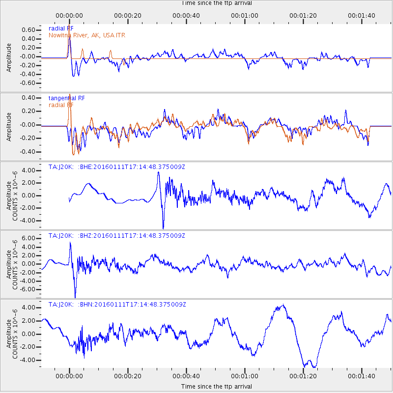
J20K Nowitna River, AK, USA - Earthquake Result Viewer
*The percent match for this event was below the threshold and hence no stack was calculated.
| Earthquake location: |
Hokkaido, Japan Region |
| Earthquake latitude/longitude: |
44.5/141.1 |
| Earthquake time(UTC): |
2016/01/11 (011) 17:08:03 GMT |
| Earthquake Depth: |
240 km |
| Earthquake Magnitude: |
6.2 MWW |
| Earthquake Catalog/Contributor: |
NEIC PDE/NEIC COMCAT |
|
| Network: |
TA USArray Transportable Network (new EarthScope stations) |
| Station: |
J20K Nowitna River, AK, USA |
| Lat/Lon: |
64.18 N/154.15 W |
| Elevation: |
314 m |
|
| Distance: |
40.4 deg |
| Az: |
37.658 deg |
| Baz: |
272.777 deg |
| Ray Param: |
$rayparam |
*The percent match for this event was below the threshold and hence was not used in the summary stack. |
|
| Radial Match: |
57.9597 % |
| Radial Bump: |
400 |
| Transverse Match: |
52.120377 % |
| Transverse Bump: |
400 |
| SOD ConfigId: |
7422571 |
| Insert Time: |
2019-04-21 17:31:00.411 +0000 |
| GWidth: |
2.5 |
| Max Bumps: |
400 |
| Tol: |
0.001 |
|
Signal To Noise
| Channel | StoN | STA | LTA |
| TA:J20K: :BHZ:20160111T17:14:48.375009Z | 3.3474252 | 2.8885509E-6 | 8.6291726E-7 |
| TA:J20K: :BHN:20160111T17:14:48.375009Z | 1.4540753 | 1.6480906E-6 | 1.1334287E-6 |
| TA:J20K: :BHE:20160111T17:14:48.375009Z | 2.5257595 | 2.2705597E-6 | 8.989612E-7 |
| Arrivals |
| Ps | |
| PpPs | |
| PsPs/PpSs | |


