You are here: Home > Network List > TA - USArray Transportable Network (new EarthScope stations) Stations List
> Station MDND Maddock, ND, USA > Earthquake Result Viewer
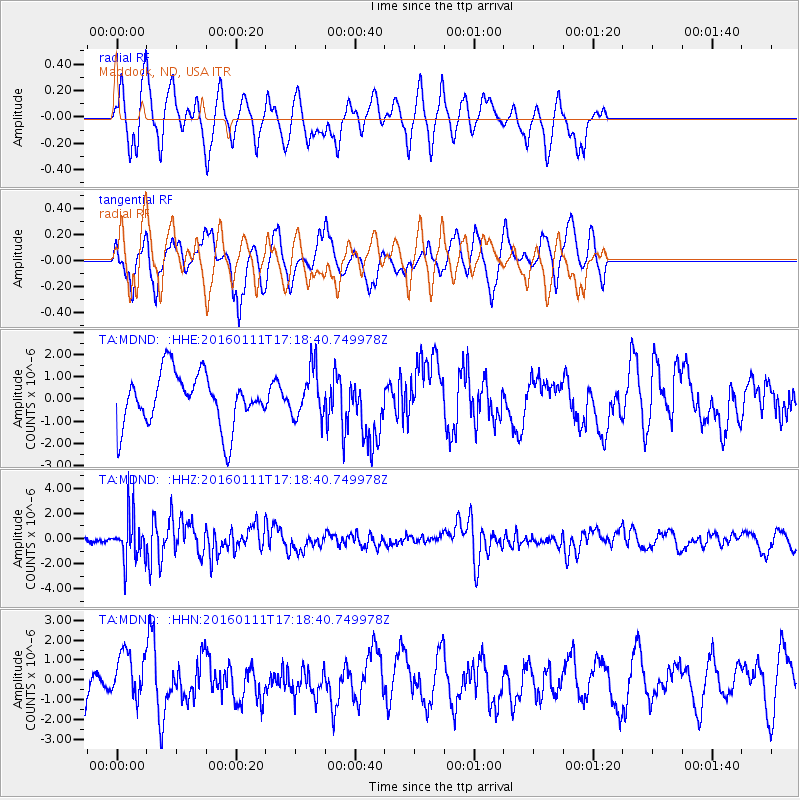
MDND Maddock, ND, USA - Earthquake Result Viewer
*The percent match for this event was below the threshold and hence no stack was calculated.
| Earthquake location: |
Hokkaido, Japan Region |
| Earthquake latitude/longitude: |
44.5/141.1 |
| Earthquake time(UTC): |
2016/01/11 (011) 17:08:03 GMT |
| Earthquake Depth: |
240 km |
| Earthquake Magnitude: |
6.2 MWW |
| Earthquake Catalog/Contributor: |
NEIC PDE/NEIC COMCAT |
|
| Network: |
TA USArray Transportable Network (new EarthScope stations) |
| Station: |
MDND Maddock, ND, USA |
| Lat/Lon: |
47.85 N/99.60 W |
| Elevation: |
479 m |
|
| Distance: |
73.8 deg |
| Az: |
37.713 deg |
| Baz: |
319.438 deg |
| Ray Param: |
$rayparam |
*The percent match for this event was below the threshold and hence was not used in the summary stack. |
|
| Radial Match: |
53.7442 % |
| Radial Bump: |
341 |
| Transverse Match: |
59.931156 % |
| Transverse Bump: |
327 |
| SOD ConfigId: |
7422571 |
| Insert Time: |
2019-04-21 17:31:11.678 +0000 |
| GWidth: |
2.5 |
| Max Bumps: |
400 |
| Tol: |
0.001 |
|
Signal To Noise
| Channel | StoN | STA | LTA |
| TA:MDND: :HHZ:20160111T17:18:40.749978Z | 4.4787045 | 1.8052305E-6 | 4.0306978E-7 |
| TA:MDND: :HHN:20160111T17:18:40.749978Z | 1.1728078 | 1.1465621E-6 | 9.776214E-7 |
| TA:MDND: :HHE:20160111T17:18:40.749978Z | 0.90396225 | 1.0794967E-6 | 1.1941834E-6 |
| Arrivals |
| Ps | |
| PpPs | |
| PsPs/PpSs | |


